Catalog Archive
Auction 156, Lot 265

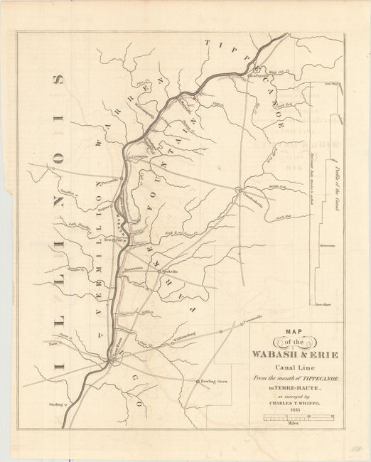
"Map of the Wabash & Erie Canal Line from the Mouth of Tippecanoe to Terre-Haute. As Surveyed by Charles T. Whippo", U.S. Government

Subject: Indiana

Period: 1835 (dated)

Publication: HR Doc. #32, 25th Congress, 3d Session

Color: Hand Color

Size:
10.3 x 12.4 inches
26.2 x 31.5 cm
Download High Resolution Image
(or just click on image to launch the Zoom viewer)

This map was originally issued in a Congressional report concerning a land grant to the State of Indiana for the purpose of opening a canal to connect the Wabash River with Lake Erie. The proposed canal is depicted in light pink. The Wabash-Erie Canal was completed in 1842. It extended to Evansville, rather than Terre Haute, as shown on this map.

References:

Condition: B+

Issued folding on a clean sheet with light offsetting. Binding trim at lower left.

Estimate: $140 - $170

Sold for: $100

Closed on 2/17/2016

Archived