Subject: World
Period: 1787 (circa)
Publication: Banke's New System of Universal Geography
Color: Black & White
Size:
18.3 x 13 inches
46.5 x 33 cm
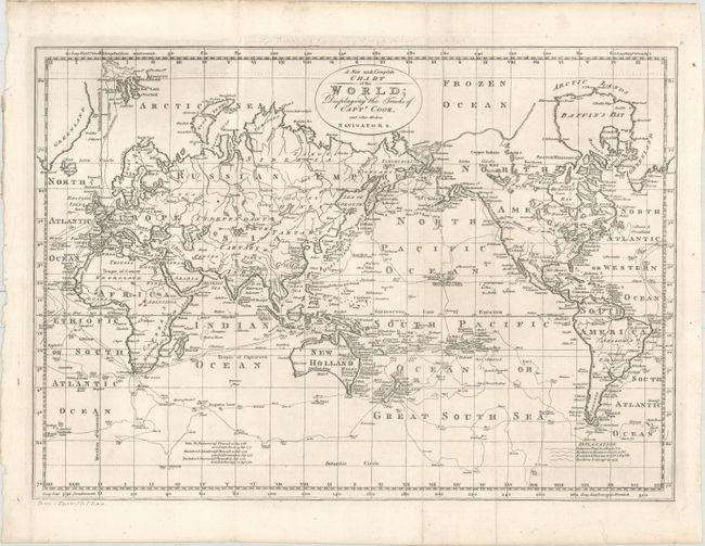
This fascinating map of the world is filled with Captain Cook's routes from all three voyages. A key at bottom right corresponds the various tracks to each voyage. In North America, there is a fictitious West River, while Alaska is shown with a fairly correct shape. A note on the northwest coast of the continent mentions Fou-sang, a mythical Chinese colony allegedly established in the 5th century. The Sandwich Islands are shown and noted as the place where Capt. Cook was killed. The South Pacific is filled with islands, and New Zealand is fully formed. Tasmania is still attached to Australia, which is shown with an incomplete southern coastline. There are numerous detailed notations throughout.
References: Phillips (Maps) p. 1094.
Condition: A
A dark impression on a clean sheet with a few minor chips and edge tears confined to the blank margins that have been archivally repaired. Issued folding and now flattened.