Subject: Southwestern Colorado
Period: 1878 (published)
Publication:
Color: Printed Color
Size:
6.1 x 9.8 inches
15.5 x 24.9 cm
This 119-page report is a thorough description of the San Juan mining district including the San Luis Valley. The seven chapters describe the nature of the region including population, lines of communication, mineral wealth and botany. Included in the text are the following two maps:
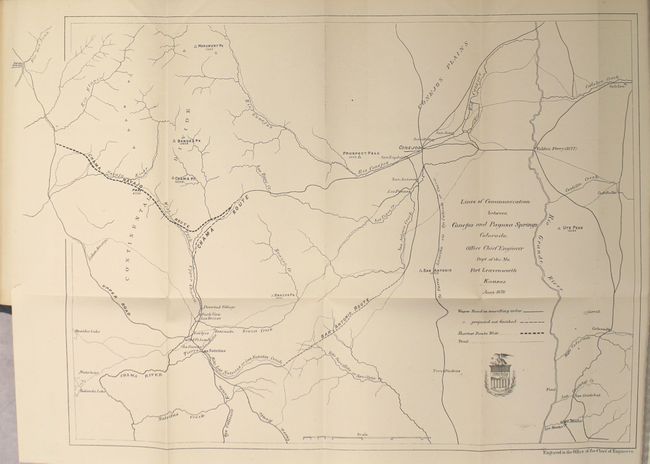
A. Lines of Communication between Conejos and Pagosa Springs Colorado (18.3 x 12.8") shows wagon roads in travelling order, those projected but not finished, and a bold line suggesting the Shortest Route West. Locates the San Antonio Route, Chama Route, the Upper Road and the route to "Tierra Amarilla via Ojo Caliente or Cuena."
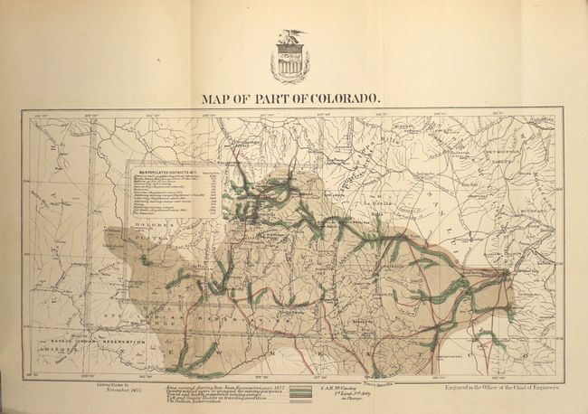
B. Map of Part of Colorado (12.9 x 6.6") depicts the region covered by the 1877 San Juan Reconnaissance with the "country settled upon or occupied for mining purposes" shaded in green. Concentric circles show the distance from Fort Garland and a table lists the most populated districts (ranging from 60 to 2,390).
8vo, rebound in green cloth and floral paper boards.
References:
Condition: A
Both maps are mostly clean and bright with minor faint offsetting. Text is very good with light toning along sheet edges. The lovely modern binding is pristine.