Subject: Central United States
Period: 1834 (circa)
Publication: Horace Everett's Regulating The Indian Department...
Color: Hand Color
Size:
18 x 17.1 inches
45.7 x 43.4 cm
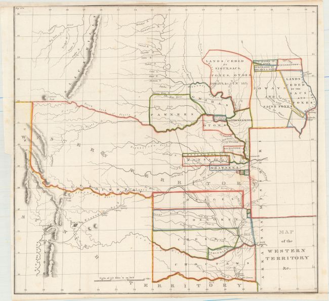
This important early map of the Indian Territories covers the region between the Yellowstone River and Santa Fe east to Fort Armstrong on the Mississippi River and Fort Smith on the Arkansas River. It is the first government map to collectively show the boundaries of the various Indian lands and land cessions west of the Mississippi. Named Indians lands and cessions include Choctaws, Seminoles, Creeks, Cherokees, Osages, and Senecas. Horace Everett’s report is important as it provided regulated trade and intercourse with the Indians and established the Western Territory providing security and protection for emigrants and the Indian tribes therein. It accompanied three House bills (Nos. 488, 489 & 490) that provided for the organization of the Dept. of Indian Affairs.
References: Wheat (TMW) #405.
Condition: B+
Issued folding, now flattened. Usual binding trim at left with a short binding tear professionally repaired. Trimmed close at bottom right and into neatline at top left, with paper laid in to facilitate framing.