Catalog Archive
Auction 156, Lot 215

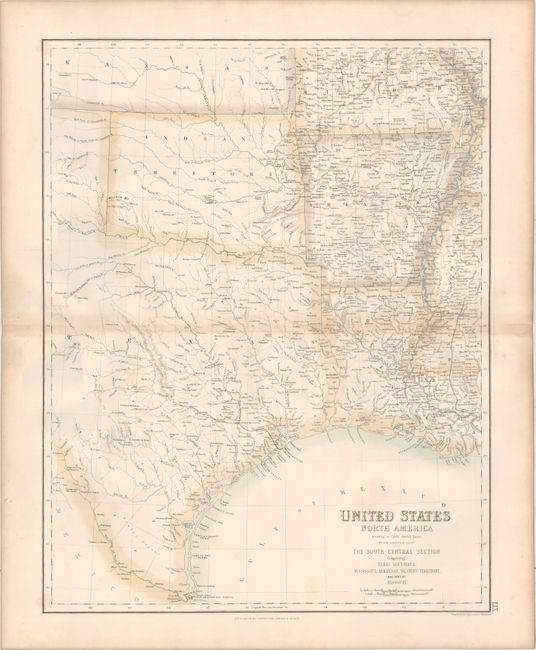
"United States North America ... The South Central Section Comprising Texas, Louisiana, Mississippi, Arkansas, Western Territory, and Part of Missouri", Swanston/Fullarton
Subject: South Central United States

Period: 1860 (circa)

Publication: Royal Illustrated Atlas of Modern Geography

Color: Hand Color

Size:
15.7 x 20.2 inches
39.9 x 51.3 cm
Download High Resolution Image
(or just click on image to launch the Zoom viewer)

This very finely engraved map is beautifully rendered and colored in a delicate pallet of pastel tones. Centered on Indian Territory, the map shows a railroad between Galveston and Houston which extends to Austin with a spur to Washington. No other railroads are shown. San Antonio is the tiny village S. Antonio de Bexar. Dallas is named. Northwest of Austin on the River Llano are "German Settlements." There is excellent detail throughout of rivers and streams. Cartography is credited "According to Calvin, Smith and Tanner".

References:

Condition: B+

Original outline color with light toning along the centerfold and faint foxing.

Estimate: $120 - $150

Sold for: $60

Closed on 2/17/2016

Archived