Subject: Georgia, South Carolina, Northern Virginia, Civil War
Period: 1891-95 (published)
Publication: Atlas to Accompany the Official Records of the Union and Confederate Armies...
Color: Printed Color
Size:
27.4 x 16.6 inches
69.6 x 42.2 cm
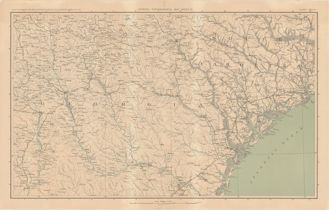
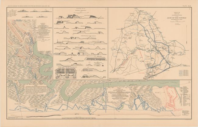
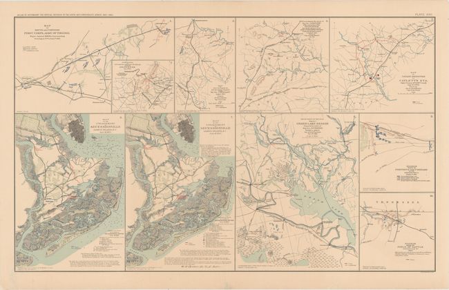
This lot of informative Civil War maps comes from the government's comprehensive atlas covering the War Between the States. These plates were issued between 1891 and 1895 to accompany the Official Army Records and were published under the Secretaries of War Redfield Proctor, Stephen B. Elkins, and Daniel S. Lamont by Maj. Gen. George B. Davis, assisted by civilian experts Leslie Perry and Joseph Kirkley. The first sheet features a map of a portion of South Carolina and Georgia. It traces the coastline from Mt. Pleasant and Charleston south to Catherine's Island and covers inland as far west as Atlanta. There is excellent detail of the area's waterways and railroads. The second sheet contains four plates including two maps and a series of diagrams depicting sections of approaches related to the Operations Against the Defenses of Charleston; the fourth plate is a map detailing the operations of the Union Army of the Potomac in northern Virginia during the winter of 1863. Ten maps appear on the third sheet, half of them focused on operations in northern Virginia, including the movement of Major General J.E.B. Stuart's men, two covering the Battle of Secessionville in South Carolina, one centered on Grand Lake in Louisiana, and two illustrating the battlefield of the Second Battle of Corinth near the Tennessee-Mississippi border.
A. General Topographical Map. Sheet IX. Condition: On a sheet with minor uneven toning, a couple small spots, and an edge tear that just enters neatline at top. (B+)
B. Plan of a Portion of the Siege Operations Against the Defenses of Charleston Harbor... [on sheet with] Sections of Approaches [and] ... Operations of the Army of the Potomac... [and] ... Siege Operations Against the Defenses of Charleston Harbor.... Condition: A hint of offsetting and some short separations along the centerfold confined to the blank margins. (A)
C. Map of Route and Positions First Corps, Army of Virginia... [on sheet with] ... Scouting Party Under Maj. Gen. J.E.B. Stuart... [and] ... Operations of the Calvary Division... [and] ... Catlett's Sta.... [and] ... Secessionville.... Condition: There are some short edge tears and chips, most of which have been repaired with archival materials. (A)
References:
Condition:
See description above.