Subject: Western North America
Period: 1801 (published)
Publication: Atlas du Voyage de Decouvertes, a l'Ocean Pacifique...
Color: Black & White
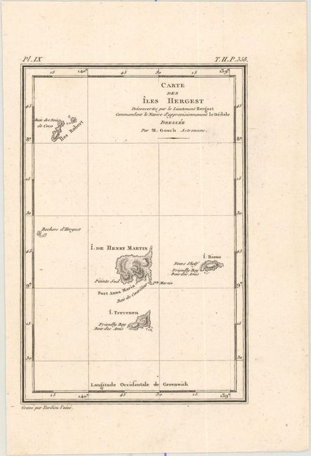
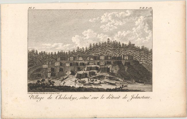
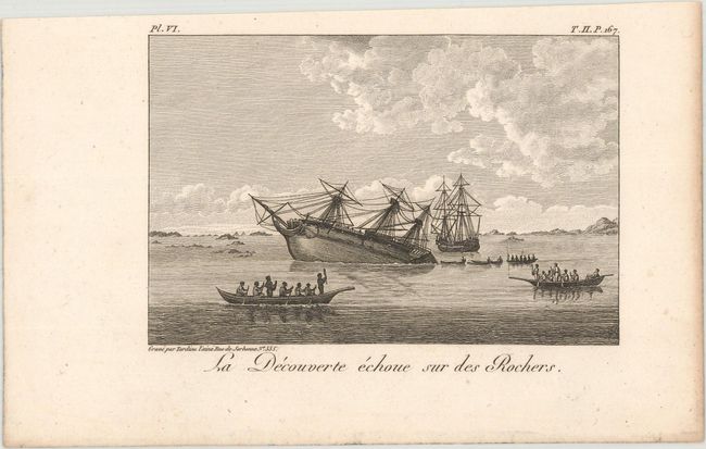
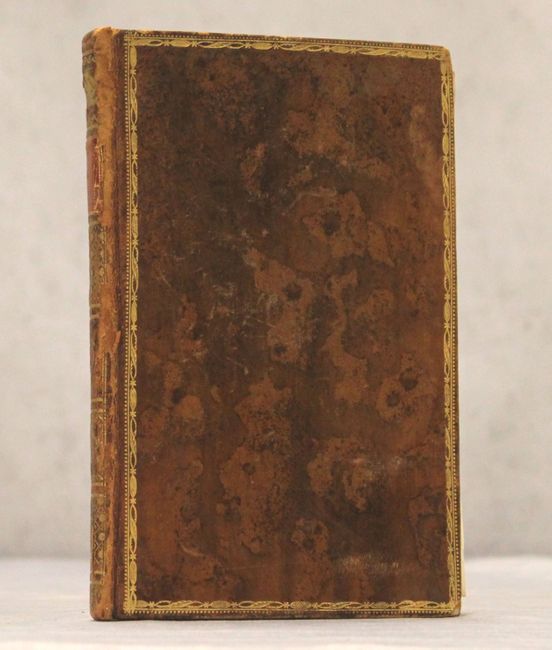
This lot comes from a French octavo edition of Vancouver's Voyages. It features six of a series of seven maps detailing Vancouver's explorations along the western coast of North America from Baja California north to Cook Inlet and Kodiak Island, the northernmost point of Vancouver's journey. The third sheet, stretching from Columbia River to north of Vancouver Island, is missing from this lot. A disbound portion of volume six of Vancouver's Voyages is included as well (with the covers, full calf with gilt tooling and title on spine), consisting of the title page, a small map of the Marquesas, and fourteen views from various stops made on the expedition.
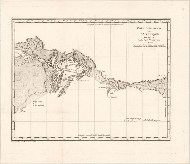
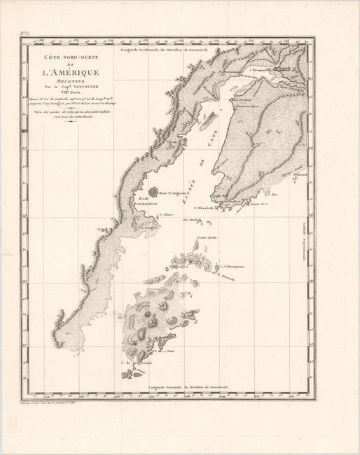
During the summers of 1792-94, George Vancouver and the crew of the British naval ships Discovery and Chatham mapped the northwest coast of North America from Baja California to Alaska. Vancouver's voyage was the last, and longest, of the great Pacific voyages of the late eighteenth century. Taking the art and technique of distant voyaging to a new level, Vancouver eliminated the possibility of a Northwest Passage and his remarkably precise surveys completed the outline of the Pacific. His expedition was also partially responsible for the British domination of Australia and New Zealand and the establishment of the Kingdom of Hawaii through his assistance to Kamehameha I, the king of Hawaii.
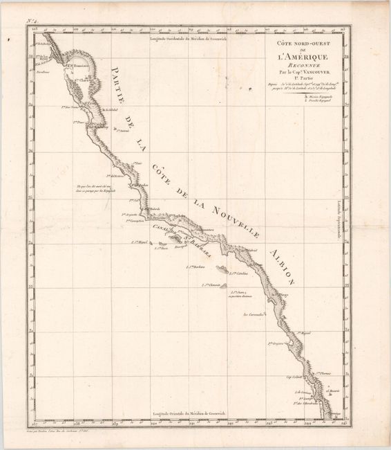
A. Cote Nord-Ouest de l'Amerique Reconnue par le Cape. Vancouver Ie. Partie, (8.7 x 10.7").
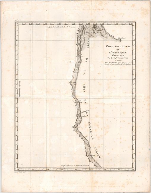
B. Cote Nord-Ouest de l'Amerique Reconnue par le Cape. Vancouver II. Partie, (8.8 x 10.8").
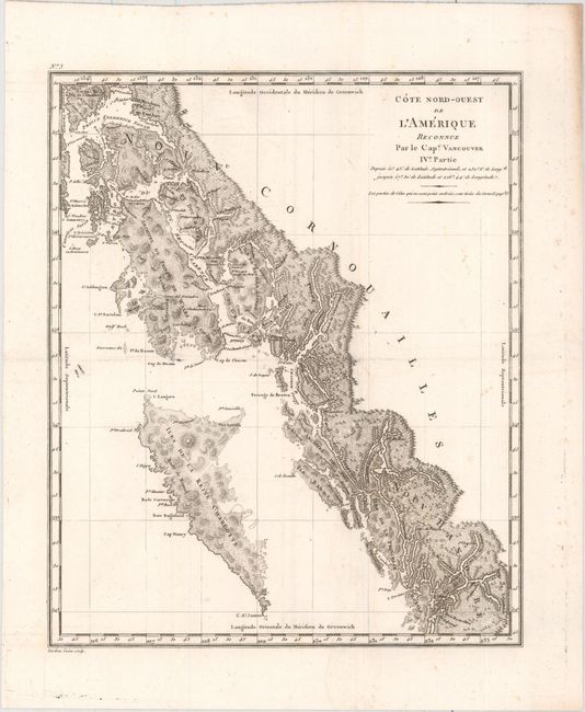
C. Cote Nord-Ouest de l'Amerique Reconnue par le Cape. Vancouver IVe. Partie, (8.9 x 10.7").
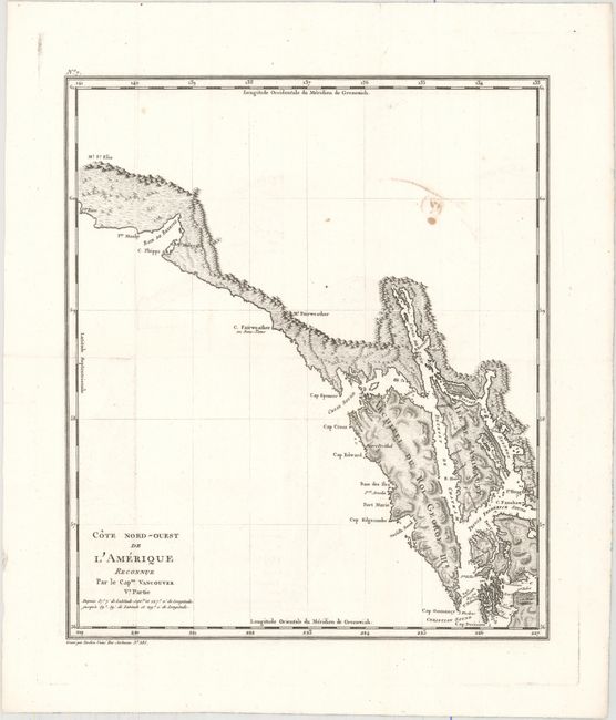
D. Cote Nord-Ouest de l'Amerique Reconnue par le Capne. Vancouver Ve. Partie, (9.1 x 10.6").
E. Cote Nord-Ouest de l'Amerique Reconnue par le Capne. Vancouver VI. Partie, (10.7 x 8.3").
F. Cote Nord-Ouest de l'Amerique Reconnue par le Cape. Vancouver VIIe. Partie, (8.6 x 10.6").
G-U. [15 Views from Vancouver's Voyages].
References:
Condition: B+
The six maps are all fine impressions issued folding on watermarked paper. The first two have light damp stains. Most of the maps and views have minor to light scattered foxing. Covers good with light wear along the spine.