Subject: North America
Period: 1804 (circa)
Publication: A New and Elegant General Atlas
Color: Black & White
Size:
9.8 x 7.9 inches
24.9 x 20.1 cm
Shortly after the turn of the century, Samuel Lewis joined with Aaron Arrowsmith (an English map publisher) to produce A New and Elegant General Atlas. The title page states the maps are "intended to accompany the new improved edition of Morse's Geography…" Several editions were published from 1804-1819. This lot includes three maps from this atlas featuring the oceans surrounding North America:
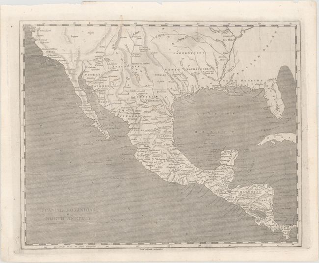
A. Spanish Dominions. An uncommon map that shows an oddly shaped western coast of Mexico, names the town of Texas on the Rio Colorado or Cannes R, locates the fictional Quivira, and much more. This copper engraved map further shows numerous place names, provinces, topography, missions, towns, forts and Indian tribes.
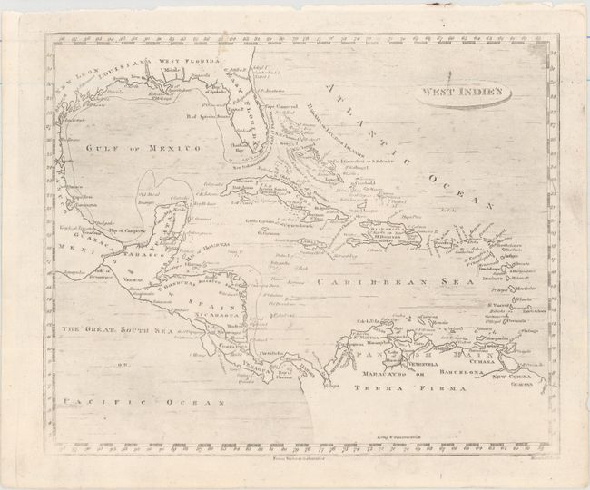
B. West Indie's. Covers the region from the Gulf Coast, through Central America, to northern South America including all the islands in the Caribbean. Florida is divided between East and West.
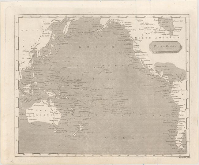
C. Pacific Ocean. The map extends from the Aleutian Islands to Terra del Fuego with numerous named islands filling the Pacific Ocean. Van Diemen's Land is shown separated from mainland Australia, but the southern coast of the continent is still conjectural.
References: Wheat (TMW) #261; Phillips (A) #702.
Condition: A
Near fine with minor surface soil and light printer's ink residue.