Subject: History Books
Period: 1795 (published)
Publication:
Color: Black & White
Size:
5.4 x 8.8 inches
13.7 x 22.4 cm
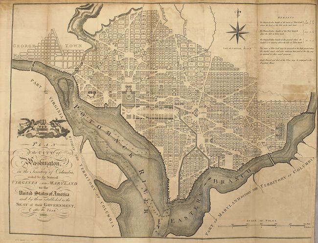
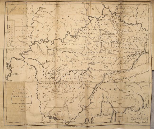
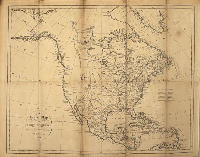
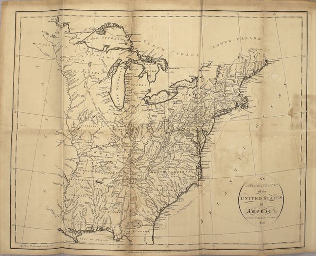
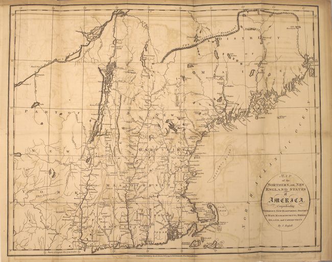
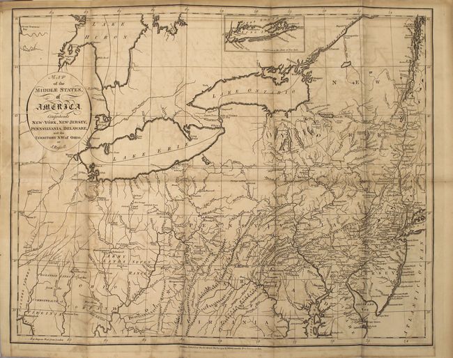
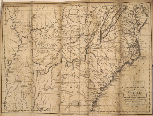
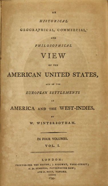
This is a complete, four-volume set of Winterbotham's work on the discovery and settlement of North America. Winterbotham also covers the American Revolution, each of the states in the Northeast through the South, Canada, the West Indies, South America, and even the flora and fauna of the Americas. Included are 11 maps, 9 of which are large folding maps. The majority of the maps are by J. Russell. The Plan of the City of Washington is nearly always missing, but is present in this example. Below is a full list of the maps:
A. An Accurate Map of the Unites States of America, According to the Treaty of Peace of 1783.
B. A General Map of North America.
C. Map of the Northern, or, New England States of America.
D. Map of the Middle States of America.
E. Map of the Southern States of America.
F. Plan of the City of Washington in the Territory of Columbia Ceded by the States of Virginia and Maryland.
G. Map of the State of Kentucky.
H. Plan of Lystra in Nelson County, Kentucky.
I. Plan of Franklinville in Mason County, Kentucky.
J. A General Map of South America.
K. An Accurate Map of the West Indies with the Adjacent Coast of America.
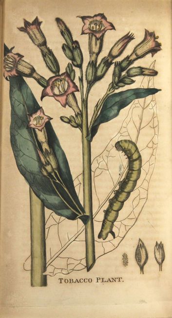
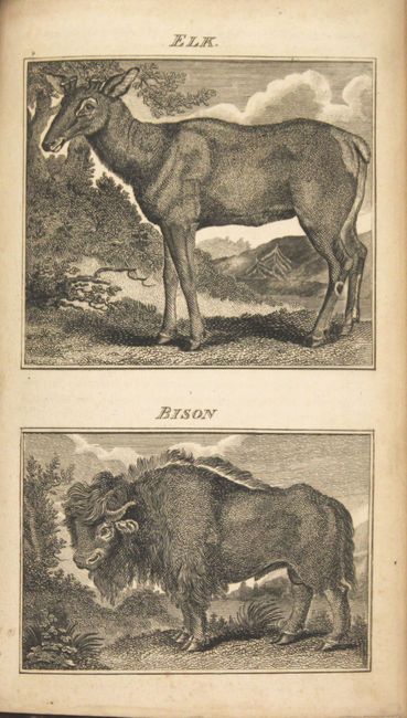
The plates include portraits of George Washington, William Penn, Ben Franklin, and Winterbotham himself. There are two plates of waterfalls, an original hand-colored plate of a tobacco plant, and 14 plates of mammals, birds, and reptiles.
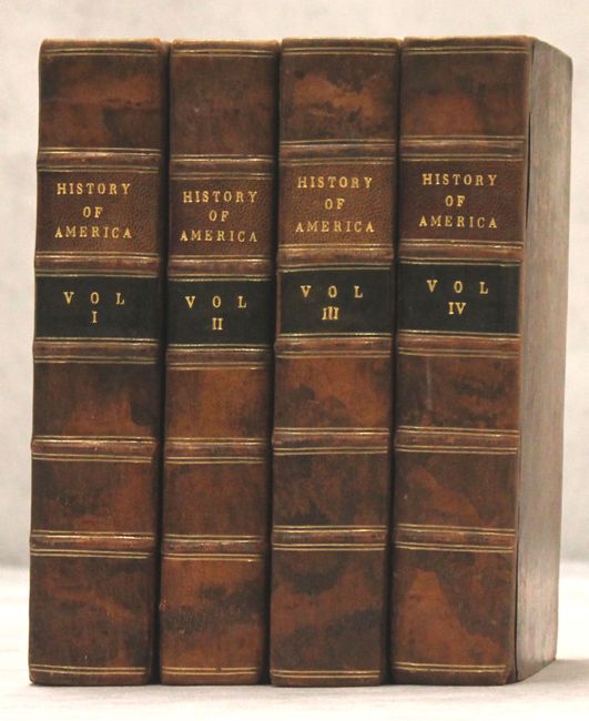
8vo, 591 pp., 493 pp., 525 pp., 415 pp. + 95 pp., index, 11 maps, 23 plates, 2 folding tables. Full tree calf with raised bands and gilt titling on spine.
References: Shirley (BL Atlases) G.WINT-1a.
Condition: B
The majority of the maps are in good condition, with light toning, light to moderate offsetting, and short binding tears, most of which have been repaired with old paper on verso. The binding tears range from 1/2" to 2", except for the map of the Middle States, which has a 3" binding tear. The plates are in very good to near fine condition, with minor toning and an occasional spot of foxing or soiling. Text is lightly toned and foxed. Contents are internally tight. The covers and spine show light wear with bumped corners. The bookplate of previous owner "J. Mirehouse" appears on the pastedown of each volume, and his signature with the date 1797 appears on the verso of the portrait of Washington in Volume I.