Subject: Atlases, Railroads
Period: 1865 (circa)
Publication:
Color: Hand Color
Size:
15.8 x 16.2 inches
40.1 x 41.1 cm
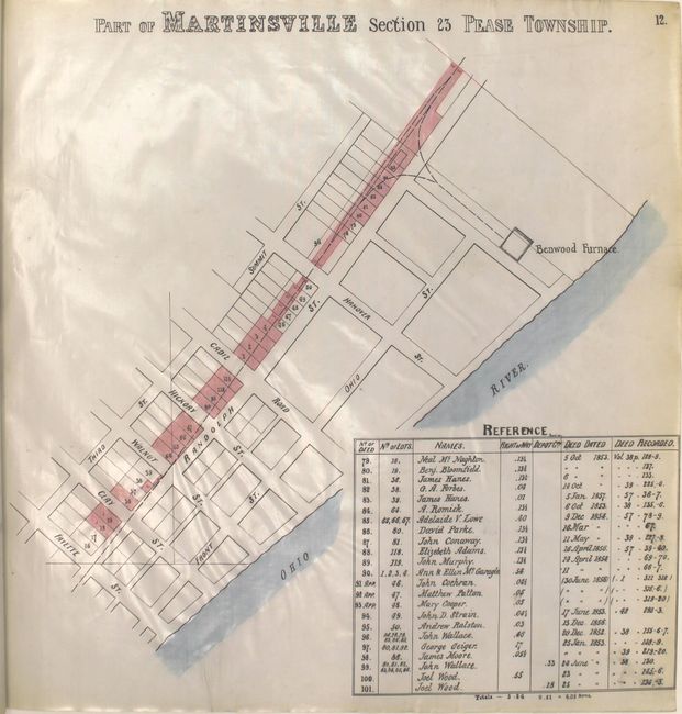
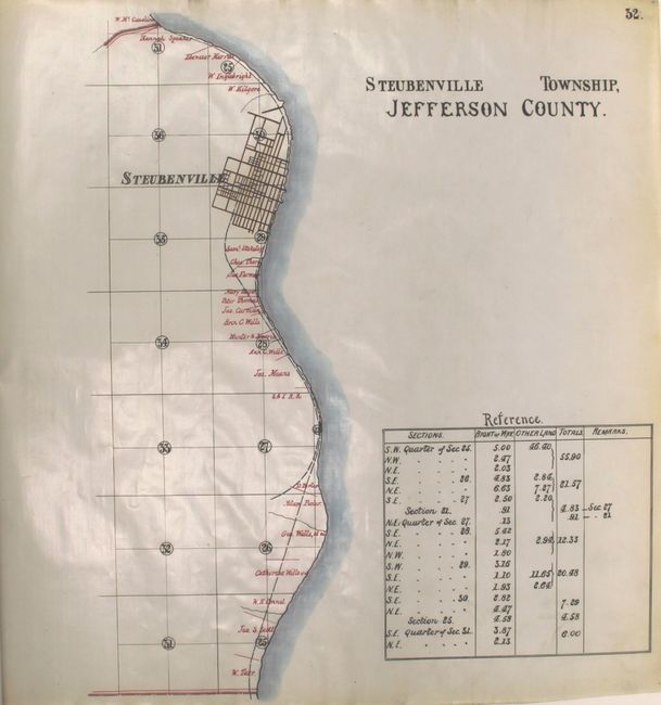
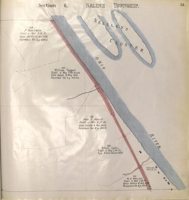
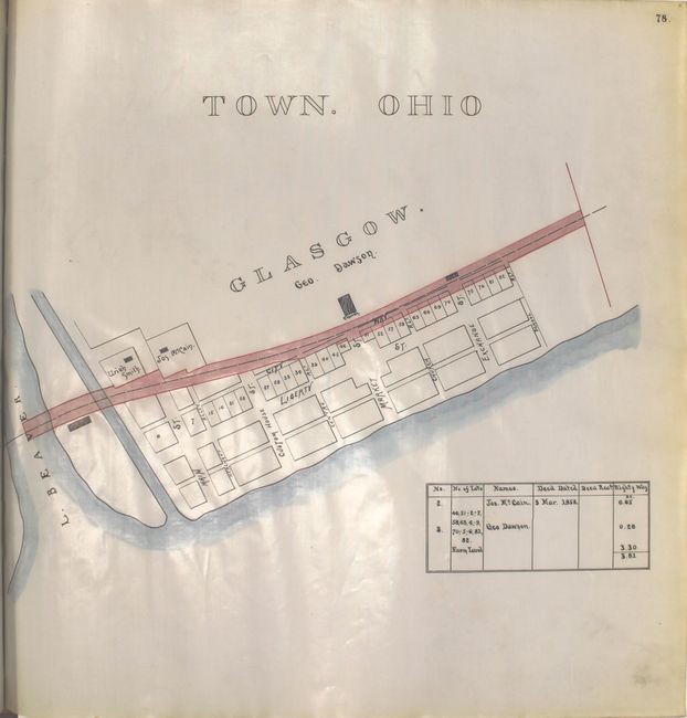
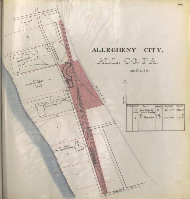
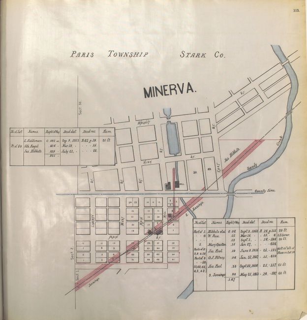
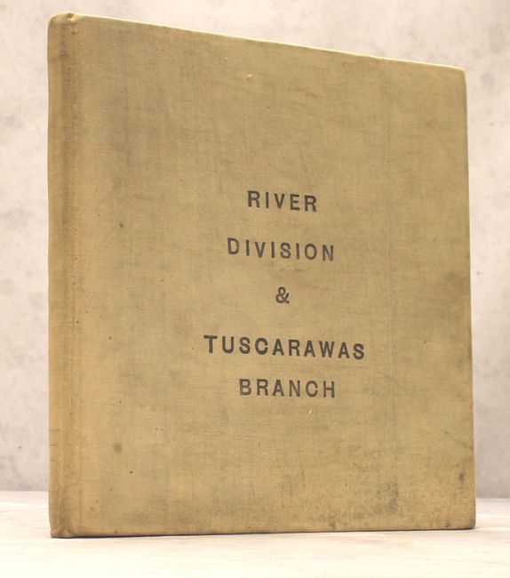
This fascinating manuscript atlas, drawn on oilcloth, is a unique and important working document showing the Cleveland & Pittsburgh Railroad acquisition of land in eastern Ohio and western Pennsylvania during the 1850s and 1860s. The atlas is divided into two parts: the River Division and the Tuscarawas Branch. The River Division consists of 106 maps from Bellaire, Ohio to the former Allegheny City, PA (annexed by Pittsburgh in 1907) while the Tuscarawas Branch includes 48 maps stretching from Bayard, OH to New Philadelphia, OH. Each of the maps is an account of deed purchases and includes the name of the grantors, the number of acres purchased for Right of Way, and the deed date. The maps are incredibly detailed showing property owners, individual lot sizes, businesses and building types. All are enhanced with red and blue hand coloring. Folio, hardbound in tan cloth.
The Cleveland & Pittsburgh Railroad was founded in 1836 and was the first railroad to serve the Cleveland area. It reached its goal of connecting Cleveland to Pittsburgh in the 1850s and was taken over by the Pennsylvania Railroad Company in 1871.
References:
Condition: A
The condition code is for the maps which are near fine with a little light toning along the sheet edges and a few extraneous pencil notations. Contents are tight and the covers are moderately soiled from use.