Subject: Western Hemisphere - America
Period: 1828 (dated)
Publication:
Color: Hand Color
Size:
9.1 x 12.3 inches
23.1 x 31.2 cm
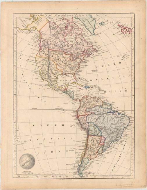
This handsome map of the Americas includes a wealth of information, including political boundaries, rivers, mountains, cities, and roads. The Southwest is still under Spanish control, and the northwestern boundary between the United States and British Colombia is left ambiguous, indicating the disputed claims over the Oregon Territory. Alaska is shown truncated to the west, separated from the eastern tip of Asia by the Bering Strait. The map extends east to show the British Isles to help the British audience understand the relative size and distance of the Americas. The title is emblazoned onto a globe as an interesting decorative element. The Arrowsmith family were among the most respected and influential English cartographers of the nineteenth century.
References:
Condition: B+
Original color with minor soiling and light toning along edges of sheet. There are small manuscript notations in and adjacent to Peru.