Catalog Archive
Auction 155, Lot 642

"To Captain Krusenstern, of the Imperial Russian Navy ... This Chart, of the Strait of Sunda...", Horsburgh, James (Capt)

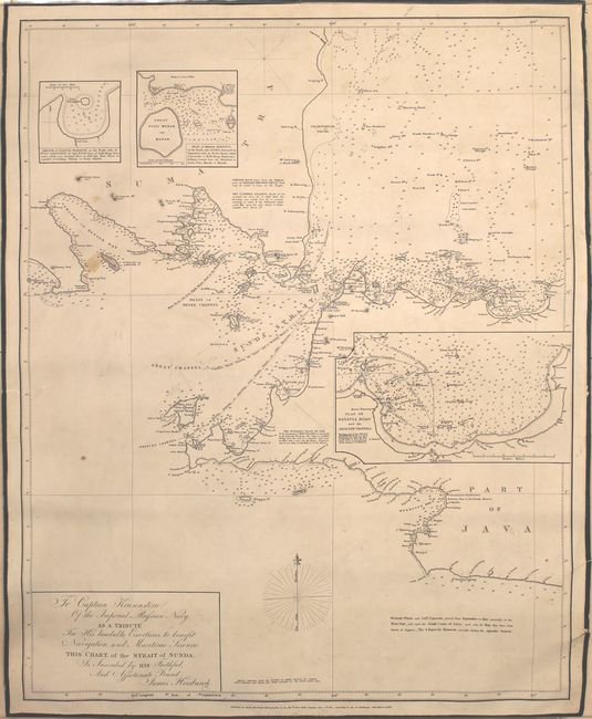
Subject: Sunda Strait, Indonesia

Period: 1853 (dated)

Publication:

Color: Black & White

Size:
24.5 x 30.5 inches
62.2 x 77.5 cm
Download High Resolution Image
(or just click on image to launch the Zoom viewer)

This dense and informative sea chart centers on the Strait of Sunda in between Sumatra and Java. Several smaller islands are identified, and depth soundings, anchorages, routes, bays, shoals, navigational notes, and mountains with their elevations are shown. There are three insets with nice detail: Sketch of Nangga Harbour on the North Side of Pulo Lagoondy..., Plan of Merah Harbour on the North Side of Java..., and Plan of Batana Road and the Adjacent Channels. Originally published in 1818, the chart has been corrected to 1853. Backed on original linen with green cloth border and cloth ties.

References:

Condition: B+

Backed on linen with light soiling, several manuscript notations, and a couple edge tears that just enter the neatline at right.

Estimate: $550 - $700

Sold for: $400

Closed on 11/18/2015

Archived