Subject: China & Korea
Period: 1670 (dated)
Publication:
Color: Hand Color
Size:
9.3 x 7.9 inches
23.6 x 20.1 cm
This scarce trio of maps gives a fascinating view of the various depictions of China based on three different Jesuit missionary sources. These maps were not typically included in Sanson's atlas of Asia, and are therefore very difficult to find.
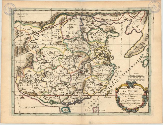
A. Abbrege de la Carte de la Chine. Du R.P. Martinius Iesuiste (9.3 x 7.9") This map is based on the work of the Jesuit Father Martino Martini during his travels between 1643 and 1650. On his return trip to Rome, Martini's ship was blown off course, forcing him to land in Norway. He subsequently made a stop in Amsterdam where he met Johannes Blaeu, and agreed to assist in the production of the Atlas Sinensis, Blaeu's atlas on China and Japan. Martini succeeded in producing very accurate maps of Japan, China, and their provinces, which may be attributed to Martini's skill as well as access to Chinese maps during his travels. First published in 1655, Martini's map of China was the first European map to show Korea as a peninsula. The mythical Chiamay Lacus (here called Kia L.) is still shown with five rivers flowing south.
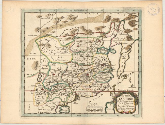
B. Abbrege de la Carte de la Chine du R.P. Bouyn Iesuiste (9.7 x 8.8") This map is based on the work of Michael Boym, a Polish Jesuit who traveled to East Asia in 1643 and spent much of his time in China until his death in 1659. He prepared a collection of maps with the intent of producing an atlas, but his work was never published. This is the only known printed version of Boym's map of China. The map shows Korea in a peninsular form, although extending too far south. A large lake (Symso Hay.) appears to the west of China, with the river Huam fl. flowing to the north.
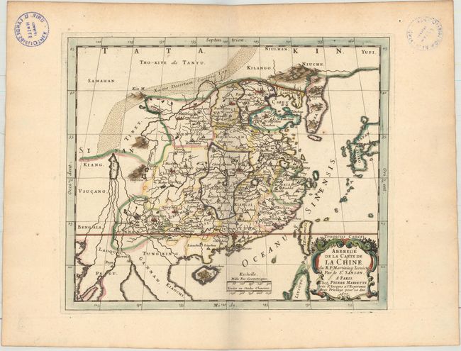
C. Abbrege de la Carte de la Chine du R.P. Michel Ruggiery Iesuiste (11.3 x 8.7") This map is based on an indigenous Chinese map copied by Jesuit Matteo Ricci, and brought back to Rome in 1590 by his fellow Jesuit, Michele Ruggieri. The map extends to include the northern tip of the Philippines and a curiously curved Korean peninsula. Although Martini's map became the most widespread and extensively copied depiction of China, Sanson based his folio-sized map of China (La Chine Royaume, first published in 1658) on Ruggieri's work.
These maps were deaccessioned from the Universitat und Landesbibliothek Sachsen-Anhalt in 2010. Documentation is available upon request.
References:
Condition: A
Crisp impressions with original outline color and later color in the cartouches. There are library stamps in the top corners of each sheet on verso, confined to the blank margins on two of the maps and entering the border on the Ruggio map. There is a faint blue shadow along the centerfolds that is caused by our scanner and does not appear on the maps themselves.