Subject: Arabia
Period: 1712 (circa)
Publication:
Color: Black & White
Size:
10.1 x 7 inches
25.7 x 17.8 cm
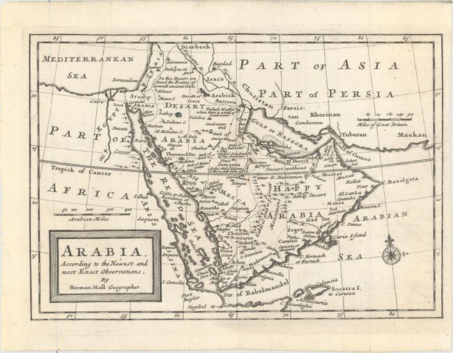
By the early eighteenth century European knowledge of the coastlines of Africa and India had advanced considerably, and the interiors of these lands were beginning to take shape. However, the lack of navigable rivers made Arabia difficult to chart, and the locations of inland towns remained largely speculative. This uncommon map is a great example of this period when cartography was largely based on unreliable and often conflicting reports. It is filled with notations, particularly concerning water or the lack thereof. The Muslim pilgrimage route from Basra to Mecca is shown.
References: Tibbetts #209.
Condition: A
A nice impression issued folding with a couple of minute rust spots and one small ink spot.