Catalog Archive
Auction 155, Lot 578

"Carte pour l'Intelligence des Voiages d'Abraham, faits par l'Ordre de Dieu, en Asie et en Egypte...", Moullart-Sanson, Pierre
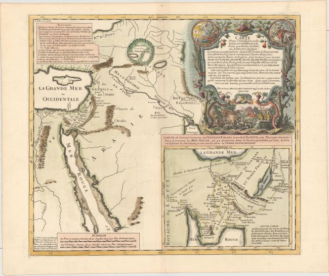
Subject: Holy Land

Period: 1712 (dated)

Publication:

Color: Hand Color

Size:
15.8 x 14.1 inches
40.1 x 35.8 cm
Download High Resolution Image
(or just click on image to launch the Zoom viewer)

This fascinating historical map shows the Holy Land from the Nile to Mesopotamia and depicts the old kingdoms and "Paradies" above Mesopotamia. A large inset shows the exodus of the children of Israel through the desert up to Jericho. A key at top left identifies the towns of Chanaan. The map is adorned with an elaborate title cartouche decorated with two Biblical scenes. The map was engraved by F. Delamonce and the cartouche was engraved by Gerard Scotin.

References:

Condition: A+

A crisp impression with attractive color on watermarked paper.

Estimate: $200 - $230

Sold for: $120

Closed on 11/18/2015

Archived