Catalog Archive
Auction 155, Lot 536

"Tirol", Hondius/Bertius
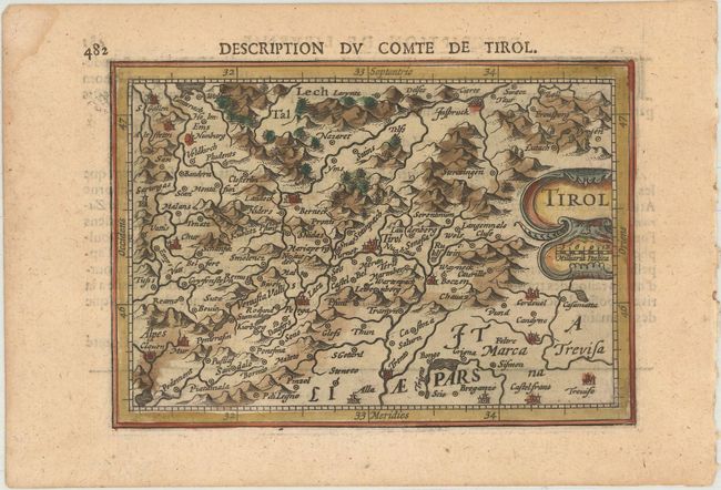
Subject: Northern Italy, Western Austria & Eastern Switzerland

Period: 1616 (circa)

Publication: Tabularum Geographicarum Contractarum…

Color: Hand Color

Size:
5.4 x 3.8 inches
13.7 x 9.7 cm
Download High Resolution Image
(or just click on image to launch the Zoom viewer)

This handsome miniature map depicts the central eastern Alps bounded by Innsbruck, Austria in the north, Chur, Switzerland in the west, and Treviso, Italy in the southeast. The mountainous topography is graphically depicted along with a number of small town and rivers. The map is adorned with a decorative cartouche that incorporates a distance scale. French text on verso.

References: King (2nd ed.) pp. 96-99; Van der Krogt (Vol. III) #2780:342.

Condition: A

A nice impression with attractive color and a faint damp stain along left side of sheet, away from image.

Estimate: $80 - $95

Sold for: $40

Closed on 11/18/2015

Archived