Subject: Cartographic Miscellany, Rivers
Period: 1823-34 (circa)
Publication:
Color: Hand Color
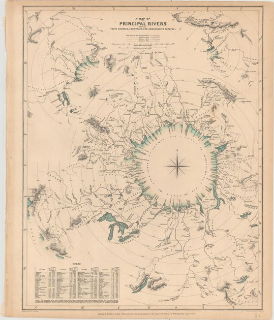
A. A Map of the Principal Rivers Shewing Their Courses, Countries, and Comparative Lengths, by SDUK, dated 1834 (12.3 x 15.5"). A very attractive and interesting comparative thematic chart uniquely arranged on concentric circles around a classic compass rose. The rivers are depicted with their relative distance from the sea, including an index of each river’s length in English miles. Associated towns and lakes are noted and respective countries are identified in capital letters keyed with an index at lower left. Two smaller, partial concentric circles located in the upper corners show additional rivers in the same fashion. This is a fine thematic map that utilizes a unique method to graphically compare the rivers of the world. Engraved by Thomas Starling and published in London by Baldwin & Cradock. Condition: Original color with minor soiling and light marginal toning.
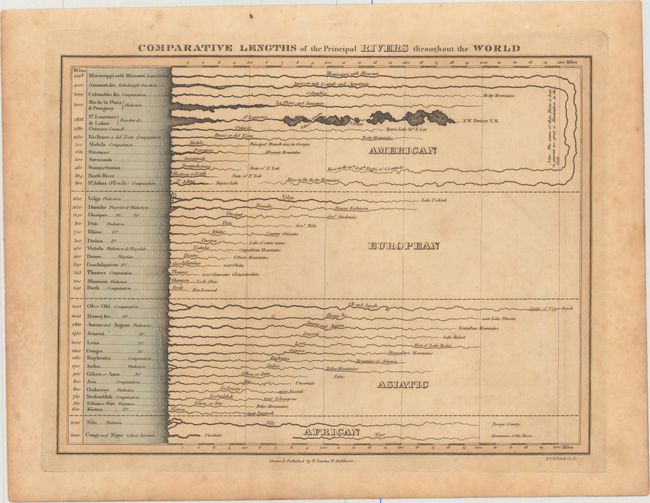
B. Comparative Lengths of the Principal Rivers Throughout the World, by Fielding Lucas, published 1823, (12.1 x 9.1"). This interesting chart lists the major rivers of the world sorted by continent. Starting at left is the length of each river, along with the name, and then a depiction of the river showing the relative width and length of each. The longest rivers, the Mississippi and Amazon Rivers are depicted wrapping around the chart. The source of each river is also listed. An interesting and uncommon sheet. Condition: Original color on "King" watermarked paper with light toning and scattered foxing.
References:
Condition: B+
See description below.