Subject: Paris, France
Period: 1841 (dated)
Publication:
Color: Hand Color
Size:
31.1 x 21.8 inches
79 x 55.4 cm
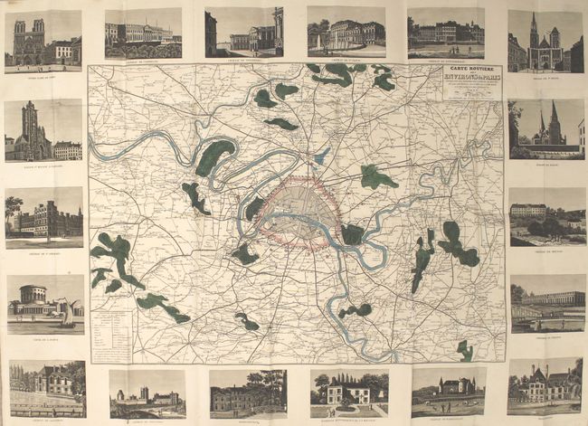
This elegant folding map by Danlos centers on Paris and extends to include the city's surroundings. The city appears in miniature plan form with some notable locations identified, including the Palais-Royal, the Louvre, Place Vendome, and Les Invalides. A majority of the map consists of the neighboring areas, which are depicted in intricate detail. Department boundaries, local roads, post roads, trails, railways, farms, windmills, chapels, forests, rivers, and more are located. Outside the neatline are 18 views showing various chateaus and interest locales such as Notre Dame, the Basilica of St. Denis, and the Palace of Versailles. Folds into cardboard covers.
References:
Condition: B+
A dark impression with several short tears and fold separations, some faint damp stains, and light soiling. There is some light wear and staining to the covers.