Subject: North Pole
Period: 1822-31 (dated)
Publication:
Color: Hand Color
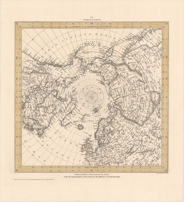
A. No. 5 Circumjacent the North Pole, by SDUK Society for the Diffusion of Useful Knowledge, dated 1831 (10.9 x 10.6"). This map was produced by Society for the Diffusion of Useful Knowledge to illustrate the latest discoveries in the Arctic. The northern regions are fairly well mapped by this time with only a few remote coastlines shown by dotted line. Alaska is still Russian Territory. Beautifully and finely engraved by J. & C. Walker. Condition: A nice impression on a clean sheet. (A)
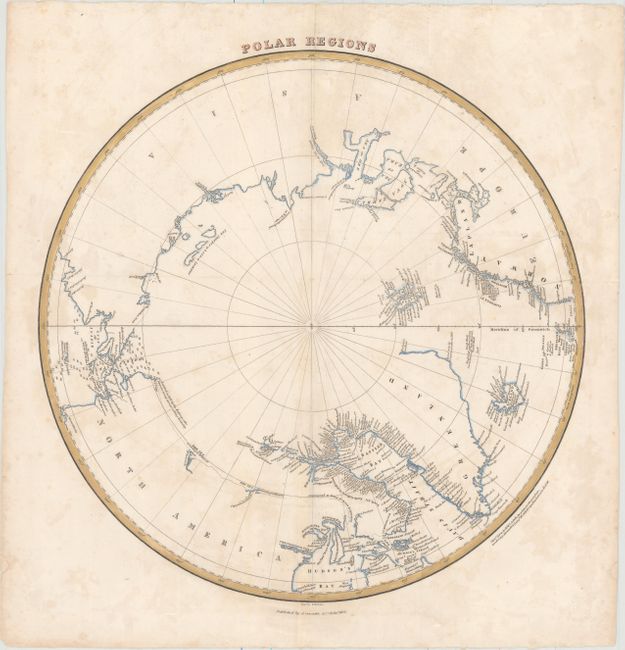
B. Polar Regions, by William Home Lizars, from Lizars' Edinburgh Geographical General Atlas..., dated 1822 (15.0 x 15.0"). This fascinating map of the North Pole shows a region still in the process of being discovered. There is little detail in western Canada beyond a few notes such as The Sea according to McKenzie or The Sea according to Hearne. The intended course of William Parry's contemporary search for a passage on the northwest end of the Hudson Bay is marked with a dotted line. The coasts of Baffin Bay are littered with place names. Bering Strait is filled with depth soundings. Published by A. Constable & Co. in Edinburgh. Condition: Issued folding with light soiling and minor scattered foxing. (B+)
References:
Condition:
See description above.