Catalog Archive
Auction 155, Lot 436

"An Accurate Map of Dorset Shire, Divided into Its Hundreds, Drawn from the Best Authorities... ", Bowen, Emanuel

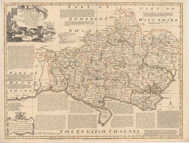
Subject: Dorset, England

Period: 1752 (circa)

Publication:

Color: Hand Color

Size:
27.5 x 21.1 inches
69.9 x 53.6 cm
Download High Resolution Image
(or just click on image to launch the Zoom viewer)

This detailed map of the county of Dorset is divided into hundreds and identifies major roads, towns, villages, churches, and schools. The text surrounding the map describes the chief towns within the county and the seats of nobility. The map is decorated by a scene of men lifting heavy stones with boats in the background, and an elaborate dedication cartouche.

References:

Condition: A

Original outline color with a professionally repaired short centerfold separation at bottom.

Estimate: $275 - $350

Sold for: $200

Closed on 11/18/2015

Archived