Subject: Britain
Period: 1695 (circa)
Publication: Atlas Royal
Color: Hand Color
Size:
23.7 x 18.9 inches
60.2 x 48 cm
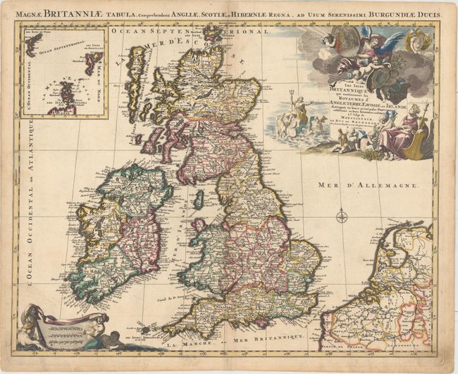
This is the first edition of this decorative folio map of the British Isles that was dedicated to the Duke of Burgundy, prior to the additional of a date at the bottom of the cartouche. Shirley states this map is "a more distinguished and firmer engraving" than the Paris edition of Cordier. He further notes the more accurate westward extension to Connaught in spite of Jaillot not using the Irish survey by Perry. Britain is shown in fine detail with hundreds of place names in this finely engraved map. The map has two stunning cartouches including the title cartouche with putti, Neptune, Mercury and other allegorical figures. The title is repeated across the top in Latin. Jaillot was the successor to the Sanson publishing family and this map follows the geography of Nicolas Sanson. Large inset details the Shetland, Faroe and Orkney Islands.
References: Phillips (A) #5953-15; Shirley (BI to 1750) Jaillot 4.
Condition: B+
A dark impression and original outline color with later coloring in the cartouches. There is very light toning along the centerfold and minor soiling in the blank margins.