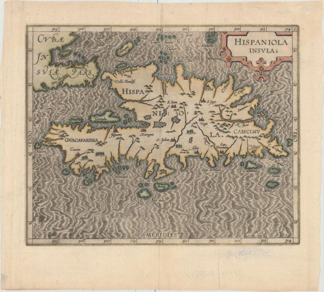
Subject: Hispaniola
Period: 1597 (circa)
Publication: Descriptionis Ptolemaicae Augmentum
Color: Hand Color
Size:
11.3 x 8.9 inches
28.7 x 22.6 cm
This is one of only two Caribbean maps in this important work, which was the first atlas dedicated to the New World. It provides an important, early view of Hispaniola with a small part of eastern Cuba. The map provides a fairly accurate depiction of the island with the locations of early colonial settlements and Indian villages. P. Nativitat on the north coast of present-day Haiti is where Columbus built his first settlement in 1492. The handsome map is embellished with a large strapwork title cartouche and a fully engraved moiré-patterned sea.
References: Mickwitz & Miekkavaara #307-9.
Condition: A
A crisp impression with attractive color and a few minute worm holes along neatline at bottom right.