Catalog Archive
Auction 155, Lot 299

"Coast Chart No. 13 Cuttyhunk to Block Island Including Narragansett Bay", U.S. Coast & Geodetic Survey

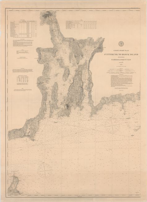
Subject: Narragansett Bay, Rhode Island & Buzzards Bay, Massachusetts

Period: 1880 (dated)

Publication:

Color: Hand Color

Size:
27.1 x 37.6 inches
68.8 x 95.5 cm
Download High Resolution Image
(or just click on image to launch the Zoom viewer)

This intricate chart extends from Block Island east to Buzzards Bay, with Narragansett Bay prominently shown at center. Depth soundings, buoys, lighthouses, reefs, rocks, bottom types, and more appear in the water. There is excellent topographical detail inland, and Providence, Newport, and Bristol are depicted in miniature plan form. At top are several tables and notes with information on the tides, lighthouses, bottom types, and more.

References:

Condition: B+

There is minor soiling, several faint extraneous creases, and a few edge tears just entering the neatline that have been closed on verso with archival tape.

Estimate: $200 - $240

Sold for: $150

Closed on 11/18/2015

Archived