Subject: Pennsylvania, Philadelphia
Period: 1909-20 (dated)
Publication:
Color: Printed Color
This lot consists of two early, large, linen-backed pocket road maps of Pennsylvania including:
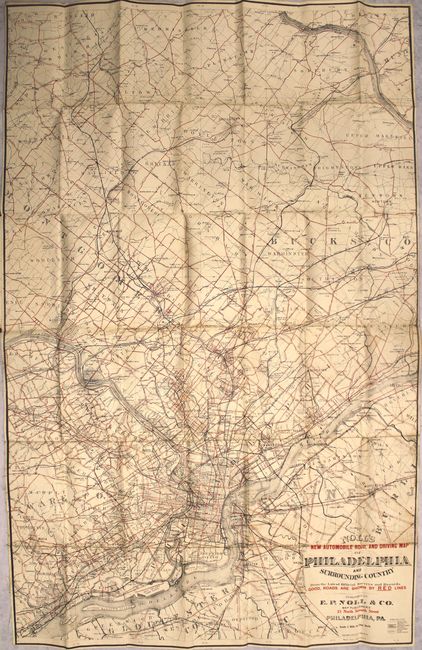
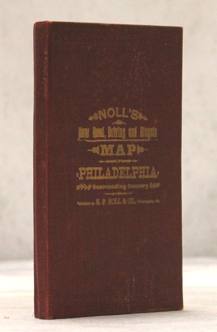
A. Noll's New Automobile Road, and Driving Map of Philadelphia and Surrounding Country from the Latest Official Surveys and Records. Good, Roads Are Shown by Red Lines, by E.P. Noll & Co., dated 1920 (27.0 x 42.4"). Highly detailed map of eastern Pennsylvania covering the region from Chester north to Lambertville, NJ with the street grid patterns depicted in the larger towns and cities. The map prominently features the "good" roads in red which were in high demand with the increased adoption of the automobile. It also locates common roads, railroads and canals. Folds into maroon cloth-covered boards with gilt title on front cover. Condition: Minor soiling primarily along the folds and a few short splits at fold intersections.
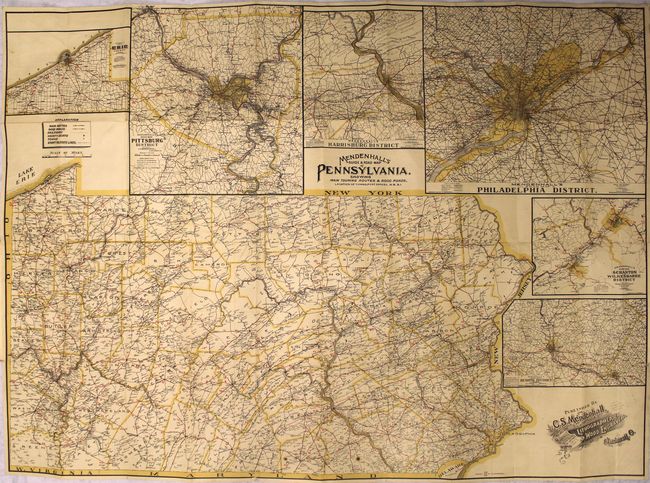
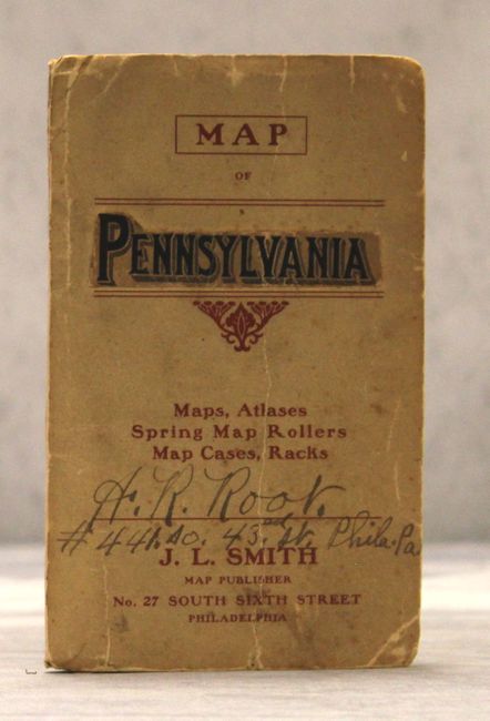
B. Mendenhall's Guide & Road Map of Pennsylvania, Showing Main Touring Routes & Good Roads, Location of Towns, Post Offices, R.R. &c., by C.S. Mendenhall, dated 1909 (37.7 x 27.5"). Delineated by county, the map identifies main routes, good roads, railroads and towns. The "main routes" also show mileage between locations. Features large insets of Philadelphia, Pittsburgh, Harrisburg, Scranton, Reading and Erie. Folds into paper wrappers with a 16-page index. Condition: Overall very good with light toning, several tiny splits at fold intersections, and two small stains at bottom.
References:
Condition: B+
See description above.