Subject: Long Island Sound, Lower Bay, New York
Period: 1853-77 (dated)
Publication:
Color:
This lot of 4 survey charts provide a comprehensive view of the waterways around Long Island. Each includes soundings, hazards, and plenty of other navigational information as well as some inland topographical detail.
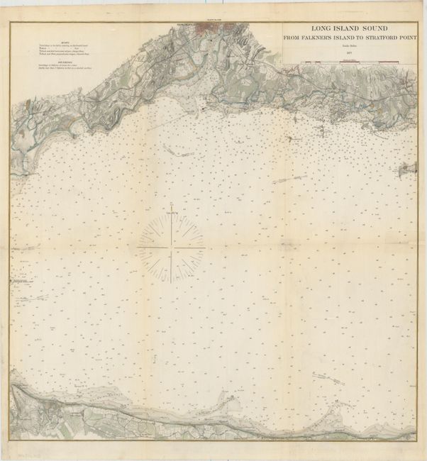
A. Long Island Sound from Falkner's Island to Stratford Point, by the U.S. Coast & Geodetic Survey, dated 1877, hand color (19.1 x 19.4"). This chart spans the Long Island Sounds from Stratford Point to Falkner's Island on the Connecticut side and Mount Misery forest to just past Jacob's Point on the New York side. Part of New Haven can be seen at top. Condition: Issued folding on thin, banknote-style paper with with minor toning along the folds, and short fold separations that have been closed with archival tape. (B+)
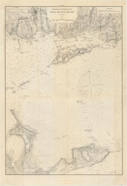
B. Eastern Entrance to Long Island Sound, by the U.S. Coast & Geodetic Survey, dated 1877, black & white (13.6 x 19.4"). This chart depicts the easternmost portion of the Long Island Sound. Little Narragansett Bay, Montauk, Gardiner's Island, and Fisher's Island are shown. Plenty of buoys and lighthouses appear. Condition: Issued folding on thin, banknote-style paper with some short archivally repaired fold separations. (A)
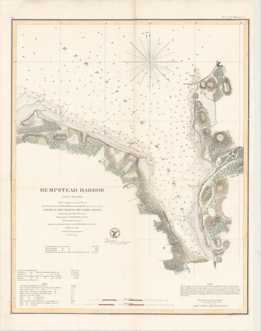
C. Hempstead Harbor Long Island..., by the U.S. Coast Survey, dated 1859, hand color (14.6 x 18.0"). This chart details Hempstead Harbor located in Nassau County in between Port Washington and Glen Cove, and opens onto Long Island Sound. Information about the tides can be found in the bottom left corner. Condition: Issued folding and backed with tissue to reinforce and repair a few fold separations. There is light soiling along one fold, a printer's crease at right, and a binding trim at lower left replaced with old paper with the border drawn in facsimile. (B+)
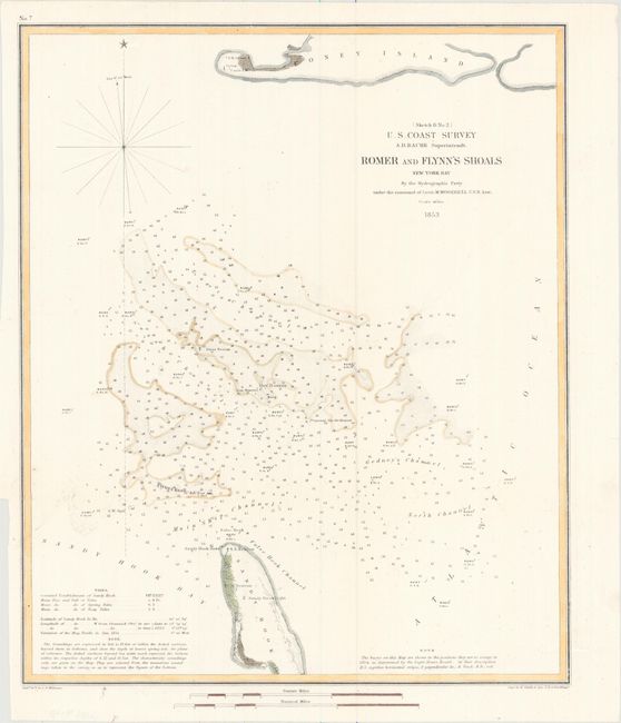
D. Romer and Flynn's Shoals New York Bay..., by the U.S. Coast Survey, dated 1853 (12.3 x 14.7"). This chart focuses on the shoals in the Lower Bay between Coney Island and Sandy Hook. There is information on the tides at bottom left. Condition: Issued folding on a clean sheet. (A)
References:
Condition:
See description above.