Subject: Montana
Period: 1897 (dated)
Publication: Sen. Doc. 194, 59th Congress, 2nd Session
Color: Printed Color
Size:
24.5 x 16.5 inches
62.2 x 41.9 cm
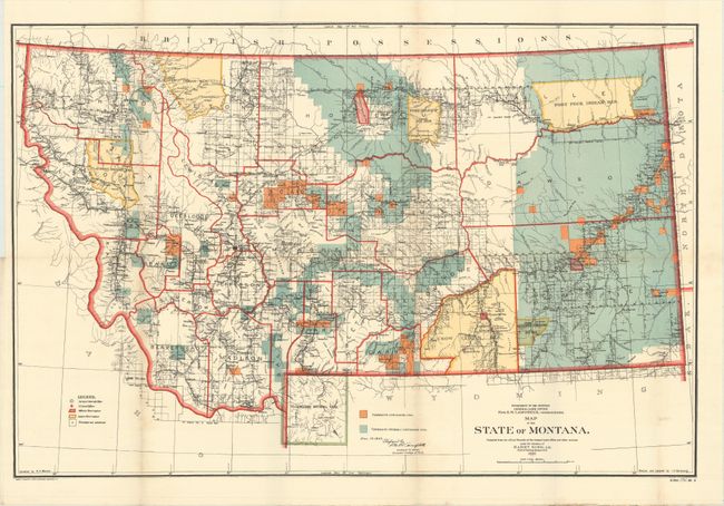
This great map details the extent of public surveys in Montana. Originally issued in 1897, the map was revised in 1906 to show townships containing "workable coal" in orange and townships "probably containing workable coal" in blue. It is densely filled with information including the location of Indian reservations (Blackfeet, Flathead, Fort Peck, Crow, etc.), military posts, and numerous railroads. The map locates Crow Agency, Custer Monument and Battlefield, and the Reno battlefield, as well as Yellowstone National Park in its entirety, including major features. The legend identifies land offices, Surveyor Generals Office, military reservations, Indian reservations, and townships not yet subdivided. Settlement and political detail include counties, county seats, towns, villages, and railroad stations. Made under the direction of Harry King, Chief of Drafting, GLO.
References:
Condition: A
Issued folding with bold color and faint toning along the vertical folds.