Subject: Cape Cod, Massachusetts
Period: 1916 (dated)
Publication:
Color: Printed Color
Size:
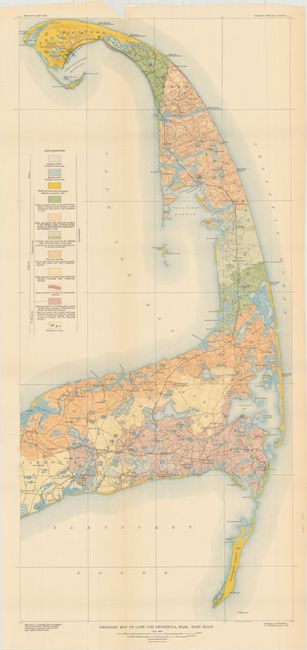
17.5 x 38.4 inches
44.5 x 97.5 cm
This large, colorful geologic map covers the portion of Cape Cod from Yalmouth and Chatham north to Provincetown. It depicts eleven different geological types in the region including swamps, marshes, dunes, sand and gravel. In addition to the geology is highly detailed topography via contour lines, the Old Colony Railroad, and numerous towns and villages. Geology by J.B. Woodworth and lithographed by Williams & Heintz in Washington DC.
References:
Condition: B+
Issued folding with vivid color on a clean sheet. There is one misfold at top left, a tear at top that extends 2.5" into the image, and a small, 0.5" puncture in a blank area of Cape Cod Bay that have both been closed on verso with archival tape.