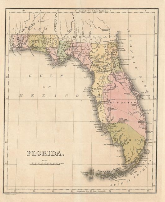
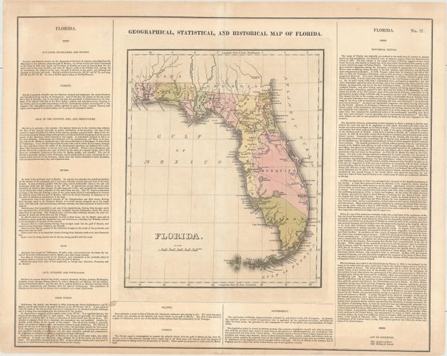
Subject: Florida
Period: 1827 (circa)
Publication: A Complete Historical, Chronological, and Geographical American Atlas...
Color: Hand Color
Size:
9.8 x 11.9 inches
24.9 x 30.2 cm
This is not the edition of this map published circa 1822, around the time that the Florida Territory was officially established as a possession of the United States, but rather the scarce edition published circa 1827. County configuration is current up to 1825, as Jefferson has not yet been created. The territory's many waterways are delineated, and proposed canals are identified. A burgeoning system of roads is traced, and land grants are identified throughout the territory. To the east of the Suwanee River is a note that refers to a "Subterraneous Passage for 3 miles." The map is on a full folio sheet (22.1 x 17.6") with English text that details the territory's climate, rivers, bays, population (estimated at this point to be around 25,000), history, and more. Andrew Jackson and William P. Duvall are listed as the territory's first two governors. Drawn by J. Drayton.
References:
Condition: B+
Original color on a slightly toned sheet with some archivally repaired centerfold separations and a couple of small stains outside the map image.