Subject: Colorado
Period: 1882 (circa)
Publication: Sen. Ex. Doc. No. 142, 1st Sess, 47th Cong.
Color:
Set of three maps related to the Sangre de Christo land grant:
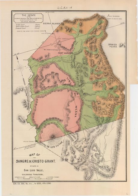
A. Map of the Sangre de Cristo Grant. Situate in San Luis Valle, Colorado Territory, hand color (11.7 x 17.4"). The estate of the Colorado Freehold land is represented by the colored portion. Identifies arable land, gold and silver land and pasture land. Topography is nicely developed. Condition: Issued folding with one tiny binding trim closed on verso with archival tape. (A)
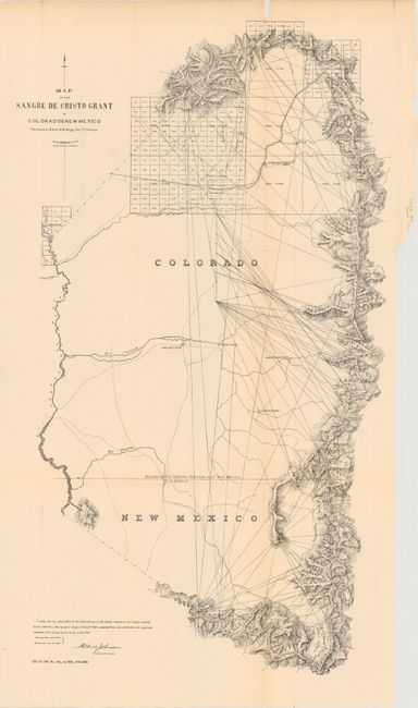
B. Map of the Sangre de Cristo Grant in Colorado & New Mexico Surveyed by Edwin H. Kellogg Dep. U.S. Surveyor, black & white (13.2 x 22.6"). A triangulation map by E.H. Kellogg showing the public land grid, Fort Garland, settlements, surveying points, Rio Grande del Norte and other rivers, creeks, mountain peaks and roads. Condition: Issued folding with numerous splits primarily along one lightly toned fold that are mostly closed on verso with archival tape. There are a few edge tears at top and a small chip resulting in minute loss of image. (B)
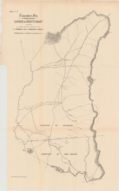
C. Topographical Map of the Exterior Boundaries of the Sangre de Christo Grant as Claimed Also Showing the Tract Purchased by the U.S. Freehold Land & Emigration Company, black & white (13.3 x 22.9"). Basic map showing rivers, roads, and topography via hachure. Condition: Issued folding with a hint of toning. (B+)
A rarely offered matched set detailing Colorado's first land grant.
References:
Condition:
See description above.