Catalog Archive
Auction 155, Lot 234

"Map Showing the Golden Gate Park the Avenue and Buena Vista Park", Britton & Rey

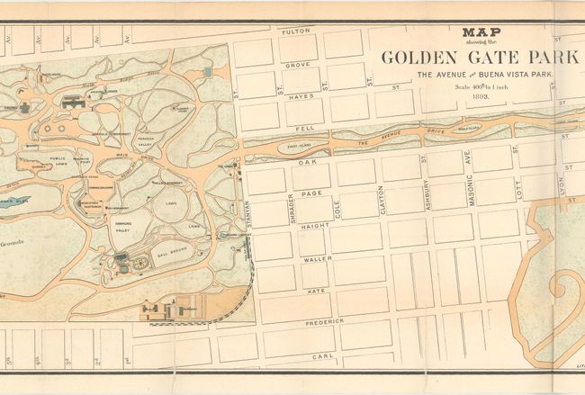
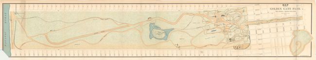
Subject: San Francisco, California

Period: 1893 (dated)

Publication:

Color: Printed Color

Size:
53.6 x 9.4 inches
136.1 x 23.9 cm
Download High Resolution Image
(or just click on image to launch the Zoom viewer)

This long, narrow map depicts the entire Golden Gate Park from Baker Street to the Pacific Ocean, showing recreational buildings, roads, trails and monuments. Golden Gate Park was founded in 1871 in an unincorporated area west of San Francisco's city limits. It is similar in shape to New York's Central Park but is actually 20% larger in size. Issued on two joined sheets.

References:

Condition: B

A bright and colorful example with light toning along the top margin and several short edge tears at bottom that just touch the neatline and have been closed on verso with archival tape. The bottom left corner of the sheet has been trimmed, resulting in a small loss of image.

Estimate: $160 - $200

Sold for: $300

Closed on 11/18/2015

Archived