Subject: California, Arizona
Period: 1875-76 (dated)
Publication:
Color: Black & White
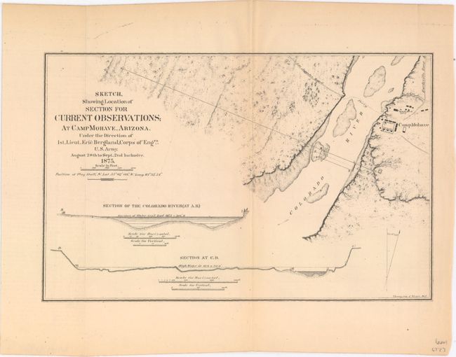
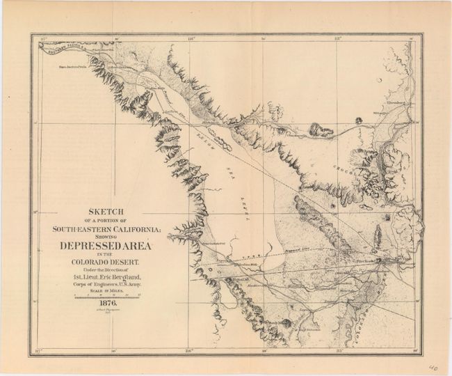
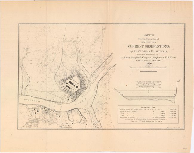
These three maps, produced under the direction of Lieut. Eric Bergland, were part of an early effort at determining the practicality of getting water from the Colorado River to the Los Angles basin. The first map shows a portion of the river near the border of Nevada, Arizona and California (Fort Mohave), while the other two show the region around Yuma, Arizona, including the soon-to-be Salton Sea. The maps feature sectional views of the Colorado River, several roads, as well as existing and proposed railroads. The reality of bringing water from the Colorado River was finally realized more than 65 years later with the completion of the Colorado River Aqueduct in 1941.
A. Sketch, Showing Location of Section for Current Observations; at Camp Mohave, Arizona..., dated 1875 (9.9 x 6.4").
B. Sketch of a Portion of South-Eastern California; Showing Depressed Area in the Colorado Desert..., dated 1876 (9.6 x 7.8").
C. Sketch Showing Location of Section for Current Observations; at Fort Yuma California..., dated 1876 (10.0 x 6.3").
References:
Condition: B+
Issued folding with light toning. The Camp Mohave map has been professionally backed in Japanese tissue.