Catalog Archive
Auction 155, Lot 210

"[Lot of 6] State of Oregon... [and] State of Washington... [and] State of Idaho... [and] State of Wyoming... [and] Map of the State of North Dakota... [and] Map of the State of South Dakota...", General Land Office

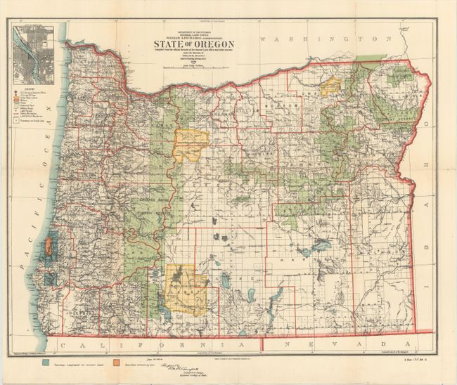
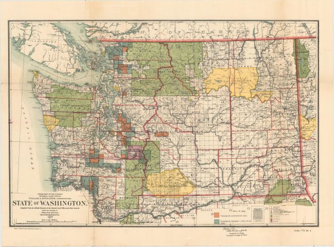
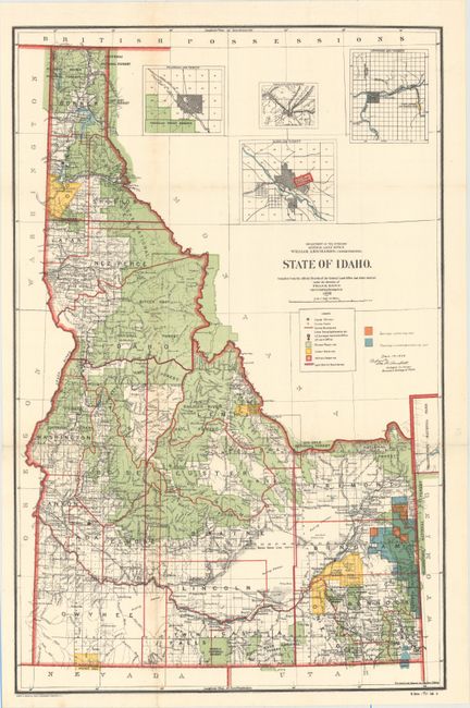
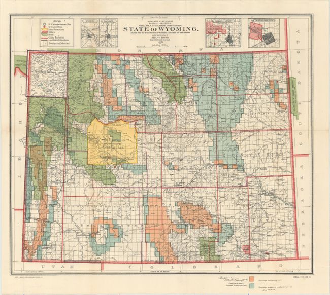
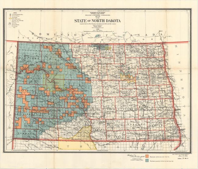
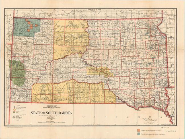
Subject: Northwestern United States

Period: 1906 (dated)

Publication: Sen. Doc. 194, 59th Congress, 2nd Session

Color: Printed Color

Size:
See Description
Download High Resolution Image
(or just click on image to launch the Zoom viewer)

This set of maps details the extent of public surveys in these six western states. The maps have all been revised to 1906, showing townships containing "workable coal" in orange and townships "probably containing workable coal" in blue. They are densely filled with information including railroads, Indian reservations, military reservations, forests, and the location of land offices. The list of maps includes:

A. State of Oregon Compiled from the Official Records of the General Land Office and Other Sources... (18.1 x 14.1").
B. State of Washington... (17.1 x 11.4").
C. State of Idaho... (14.3 x 21.9").
D. State of Wyoming... (16.5 x 14.1").
E. Map of the State of North Dakota... (16.9 x 12.9").
F. Map of the State of South Dakota... (17.5 x 11.9").

References:

Condition: A

Issued folding with vivid color and some occasional light toning along the folds.

Estimate: $275 - $350

Sold for: $210

Closed on 11/18/2015

Archived