Subject: World, Asia
Period: 1760-97 (circa)
Publication:
Color: Black & White
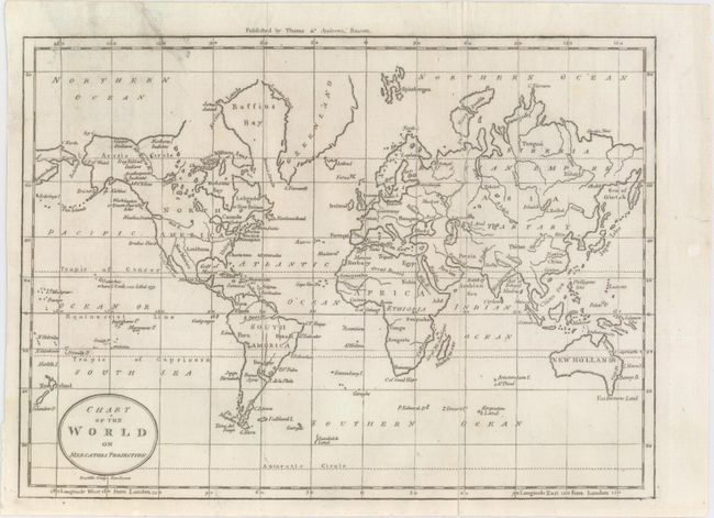
A. Chart of the World on Mercators Projection, by (Rev.) Jedidiah Morse, from The American Universal Geography, circa 1796 (9.9 x 7.3"). This map was Morse's second chart of the world. The United States appears to the east of the Mississippi with a few key cities identified, while the areas to the west of the Mississippi are labeled as Louisiana and New Mexico. A West R. runs from the center of North America to Nootka Sound. Numerous Indian tribes are located in present-day Alaska, and the Bering Strait is identified. Canada and Greenland's northern boundaries are left vague. A note in Hawaii marks the spot where Captain Cook was killed. New Guinea is depicted with an incomplete border, and Van Diemens Land is attached to the mainland of New Holland. Published by Thomas & Andrews, Boston and engraved by Amos Doolittle. Reference: McCorkle (18th C. Geography) #304-17; Wheat & Brun #31. Condition: Issued folding with minor soiling and archival repairs to a long fold separation at right and a short tear at top left. (B+)
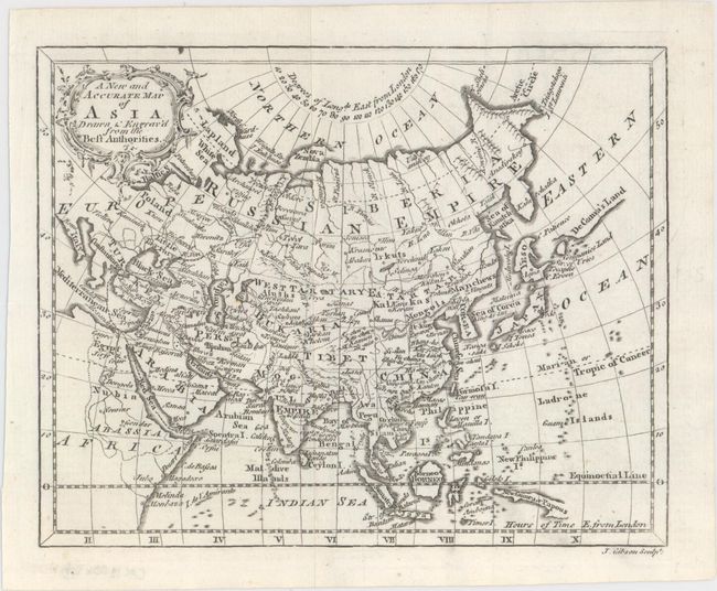
B. A New and Accurate Map of Asia Drawn & Engrav'd from the Best Authorities, by John Gibson, circa 1760 (7.1 x 5.6"). This small but densely detailed map of the continent is teeming with place names. A sliver of coastline labeled as De Gama's Land appears to the east of Hokkaido (Yeso), and the borders of Novaya Zemlya and New Guinea or Papous are incomplete. The Sea of Japan is named the Sea of Corea. An ornate title cartouche adorns the top left corner. Condition: Clean and bright, issued folding. (A+)
References:
Condition:
See description above.