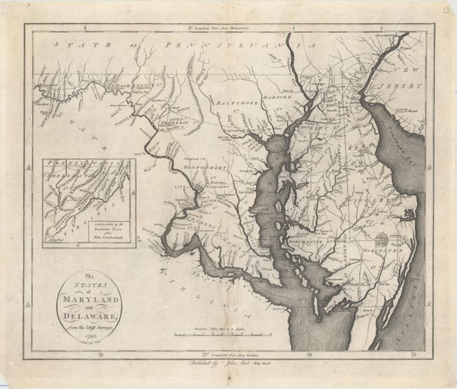
Subject: Maryland & Delaware
Period: 1795 (dated)
Publication: The American Atlas
Color: Black & White
Size:
17.2 x 14.2 inches
43.7 x 36.1 cm
This is the second state of this uncommon and early map of Maryland and Delaware, with the publisher's imprint imperfectly erased and changed from "Wayland, Reid, & Smith" to "Published by John Reid, New York." Reid's American Atlas was only the second atlas focused on America to be published in the United States. Derived from Samuel Lewis's 1794 map, this map extends as far north as Philadelphia and as far west as Fort Cumberland, with an inset that tracks the Potomac even farther west. Counties, towns and cities (including Washington and Baltimore), roads, and waterways are named, with some scattered topographical details. Portions of surrounding states are depicted but largely unengraved. Engraved by D. Martin.
References: Wheat & Brun #517.
Condition: B+
On watermarked paper with a 3" tear near the centerfold at bottom that has been repaired with archival materials, minor soiling, and some printer's ink residue. There are some small holes in the blank margins, some of which have been backed in tissue.