Subject: Canada & United States
Period: 1804 (circa)
Publication: A New and Elegant General Atlas...
Color: Black & White
Size:
9.8 x 7.9 inches
24.9 x 20.1 cm
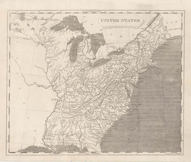
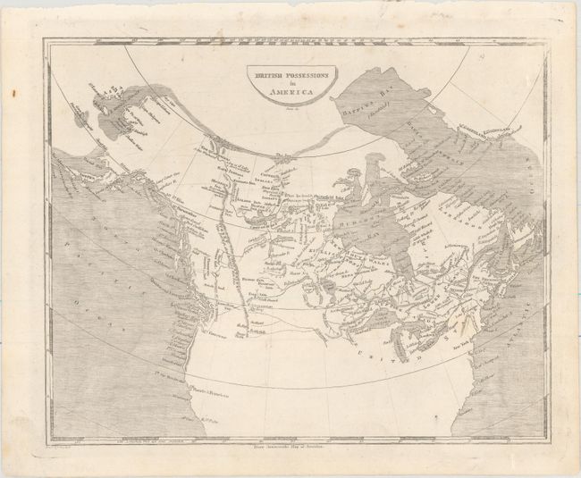
Shortly after the turn of the century, Samuel Lewis joined with Aaron Arrowsmith (an English map publisher) to produce A New and Elegant General Atlas. The title page states the maps are "intended to accompany the new improved edition of Morse's Geography…" Several editions were published from 1804-1819. This lot includes the following maps from this atlas:
A. United States. This small map depicts the United States confined to east of the Mississippi River, with the recently acquired Louisiana to its west. Florida is divided into East and West, and Mississippi Territory consists of present-day Alabama and Mississippi. To the west of Ohio is an unnamed Indiana Territory with Vincennes as its capital, bounded by the Illinois and Ohio rivers. Louisiana is virtually blank with the exception of the Missouri River. Drawn by Lewis and engraved by Tanner.
B. British Possessions in America. This map encompasses all of Canada with a possible Northwest Passage via Baffin Bay to the Bering Strait marked as "doubtful." In the far north, the map notes that the sea was seen by Hearne and MacKenzie in 1771 and 1789 respectively. Numerous Indian tribes are located, along with rivers, lakes and the Stoney Mountains. Engraved by Jones.
References: Phillips (Maps) p. 874; Phillips (A) #702.
Condition: A
Nice impressions with minor soiling in the top blank margins.