Subject: Eastern Canada
Period: 1700 (circa)
Publication:
Color: Hand Color
Size:
18.4 x 23.8 inches
46.7 x 60.5 cm
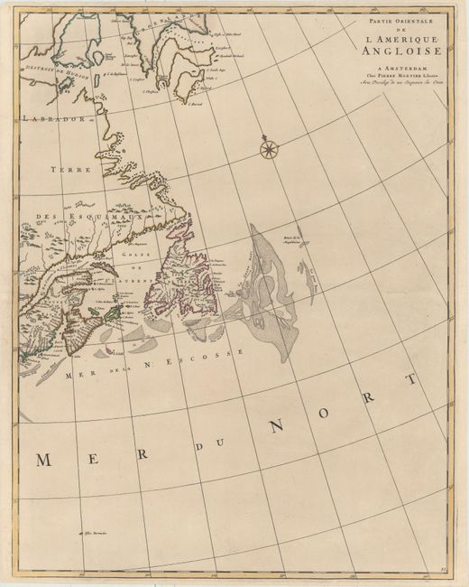
This is the eastern half of Mortier's two-sheet map of the eastern United States and Canada: "Carte Nouvelle de l'Amerique Angloise Contenant la Virginie, Mary-Land, Caroline, Pensylvania, Nouvelle Iorck, N: Iarsey N: France, et les Terres Nouvellement Decouerte..." This sheet features the great fishing banks off the northeast coast of North America. The map extends from Casco Bay to Greenland, including Newfoundland and the Bay of St. Lawrence with the tiny island of Bermuda also included.
References:
Condition: A
A dark, crisp impression with original outline color and professional repairs to several separations along the centerfold and to a tear that enters 1" into map at bottom. Narrow but ample top and bottom margins, as issued.