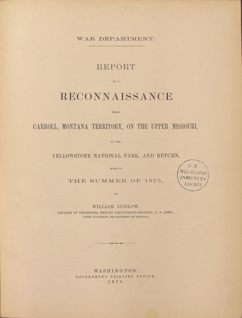
Subject: Exploration and Surveys
Period: 1876 (published)
Publication:
Color: Black & White
Size:
9.4 x 12 inches
23.9 x 30.5 cm
Carl Wheat hypothesizes that Capt. William Ludlow (1843 - 1901), Corps of Engineers, was assigned the task of surveying the road from Carroll, Montana on the Missouri to Fort Ellis near Bozeman as a reward for good service, since it allowed him to inspect the wonders of Yellowstone without a furlough. In his report, Ludlow says "My own interest in this land of wonder is so keen as to lead me again to hope that it will be protected from the vandalism which it has already suffered, and that the suggestion of an accurate topographical and geological survey, to complete the work so well inaugurated by Professor Hayden, may be made the subject of favorable consideration and recommendation by the Chief of Engineers."
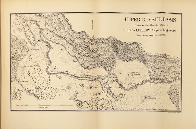
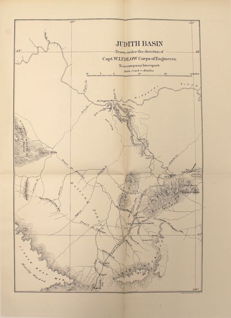
Ludlow's report contains his journal of the trip, natural history reports (palaeontology by George Bird Grinnell and geology by E. S. Dana), and Lieut. R. E. Thompson's reports on a trip to the Judith Basin and topographical work. In his report, Ludlow records many observations of the scenic and thermal features of the Park (Yellowstone Falls, Mammoth Hot Springs, Old Faithful, etc.), "wormy" trout, slaughter of game, and other interesting notes. He measured the height of the Upper and Lower Falls of the Yellowstone River with greater accuracy than previously given by the Jones expedition. His recommendations include transferring control of the park to the War Department so that troops can be stationed to act as guards at Yellowstone Lake, Mammoth Springs, and the Upper Geyser Basin. This recommendation was not acted upon, but many others, including improved roads and lodging to accommodate visitors, were later approved.
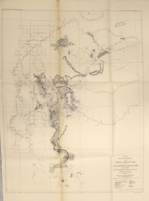
The report contains three folding maps: Judith Basin (12 x 17.2”), Upper Geyser Basin (15.5 x 8.9”) and Map of a Reconnaissance from Carroll, Montana Ter. to the Yellowstone National Park and Return (19 x 24.8”). This last map describes the newly opened Carroll Road. The road cut more than 200 miles from the previous route between Helena and Corinne. This resulted in a savings of about fifteen days considering the 12 or 13 miles per day the heavy bull-trains averaged. The map shows a large area from the Missouri River in the north to Helena in the west and the newly established National Park in the south. The flow of the Yellowstone, Musselshell, and Missouri Rivers are designated.
Quarto, hardbound in original blue pebbled cloth with gilt title on spine. 155 pages with three folding maps, two plates of fossils, and numerous in-text illustrations.
References: Wheat (TMW) #1257-1259; Howes #L-557.
Condition: A
Maps are clean, crisp and near fine. The large folding map of Carroll Road has light toning along one fold and a short binding tear confined to the left blank margin. Text is also clean. Binding is tight with the exception of one signature which is partially separated. There is light shelf wear to covers and spine. Library stamp on title page and library bookplate on inside front cover with a deaccession stamp.