Subject: Northwestern Africa
Period: 1619 (published)
Publication: Gerardi Mercatoris - Atlas sive Cosmographicae
Color: Hand Color
Size:
19 x 14.1 inches
48.3 x 35.8 cm
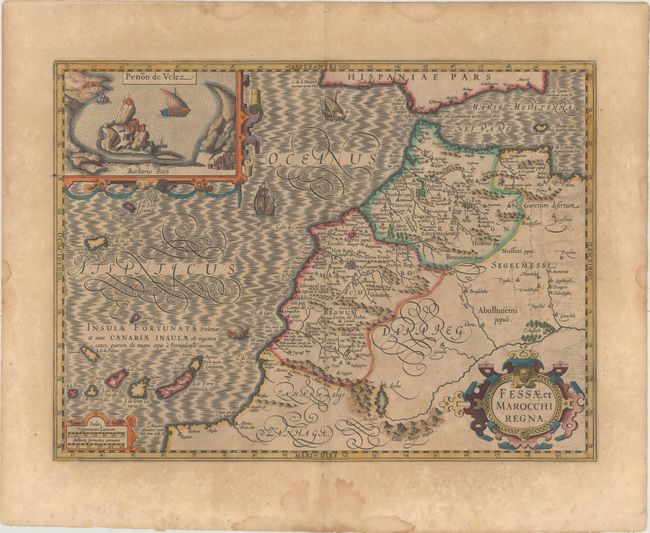
This is one of the most decorative maps of the important kingdoms of Fez and Morocco. A large inset titled Penon de Velez shows the Spanish fort off the Barbary Coast. The map extends into the Atlantic to include the Canary Islands and Madeira. It is richly engraved and embellished with three strapwork cartouches and the sea is filled with ships and a sea monster. This is the first of two maps of the region that were made for Mercator's Atlas. French text on verso.
References: Van der Krogt (Vol. I) #8615:1A.
Condition: B+
Full original color with light toning, some printer's ink residue at right, and scattered foxing primarily confined to the blank margins. There are some damp stains in the blank margins, not affecting the image.