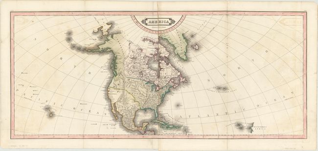
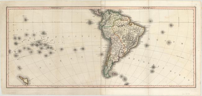
Subject: Western Hemisphere - America
Period: 1818 (circa)
Publication:
Color: Hand Color
Size:
35.1 x 15.3 inches
89.2 x 38.9 cm
Large map of the Americas printed on 4 folio sheets and joined to form a North America sheet and South America sheet. The map extends into the Pacific Ocean to include Hawaii and the South Pacific including the north island of New Zealand, and into the Atlantic to include the Azores and Cape Verde Islands. In North America the United States extends into present-day Canada in the Northwest. Alaska and much of western Canada is Independent Countries. The Rocky Mountains are shown as a mostly straight spine running north to south. The area of the Great Basin is mostly blank with one river traversing its interior. Circa date is based upon Maine still being a district (statehood in 1820 as part of the Missouri Compromise) and no Illinois (1818) or Missouri (1821).
References:
Condition: B
There are several long fold separations and two edge tears that just enter the image that have been repaired on verso with archival material. Light offsetting and a few spots of foxing.