Subject: Northeastern Spain
Period: 1696 (dated)
Publication: Mercurio Geografico…
Color: Hand Color
Size:
16.6 x 21.6 inches
42.2 x 54.9 cm
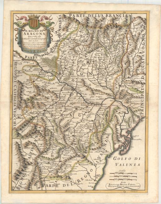
This handsome map of the historical region of Aragon is bisected by the Ebro River and centered roughly on Zaragoza. The map extends east to Lerida, south to Castello de la Plana, and west to Calahorra. Towns, political boundaries, rivers, forests, and mountains fill the map. A legend in the Gulf of Valencia identifies archbishoprics, bishoprics, abbeys, and universities. A drape-style-title cartouche fills the upper left corner. The map was created by Giacomo Cantelli da Vignola, a cartographer from Modena, Italy, who worked on many maps in Giovanni Giacomo de Rossi's atlas, Mercurio Geografico. Engraved by A. Barbey.
References: Shirley (BL Atlases) T.ROSS-1d #71.
Condition: B+
A dark impression with attractive color, very light toning along the centerfold, and minor soiling.