Catalog Archive
Auction 154, Lot 463

"De Custen van Schoonen en Swede van Valsterboen tot Christianopolis Bornholm en de Custen van Pomeren van't Eylant Rugen tot Rygs-Hoost", Colom, Arnold
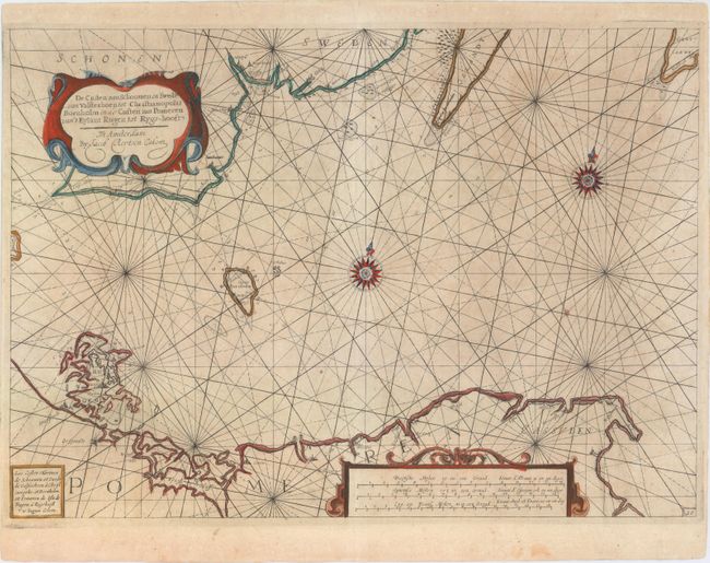
Subject: Baltic

Period: 1649 (circa)

Publication: The New Fierie Sea-Colomne...

Color: Hand Color

Size:
20.6 x 14.7 inches
52.3 x 37.3 cm
Download High Resolution Image
(or just click on image to launch the Zoom viewer)

This uncommon sea chart covers the southern part of the Baltic Sea. It extends from southern Sweden to the historical region of Pomerania (located in present-day Germany and Poland). The islands of Bornholm, Rugen and the southern tips of Oland and Gotland are shown. Towns and cities are located along the coastlines. Soundings, anchorages and hazards are speckled throughout the sea, which is decorated by crisscrossing rhumb lines and two compass roses topped with fleurs-de-lis. There are two strapwork cartouches for the title and distance scales, respectively.

References:

Condition: B+

A nice impression with a few professionally repaired tears and light soiling.

Estimate: $800 - $950

Sold for: $600

Closed on 9/16/2015

Archived