Catalog Archive
Auction 154, Lot 409

"Afteekening van het Eyland Man in St. Georges Channell Tussen Irland en Engeland [on sheet with] Afteekening van het Canaal Anglesey... [and] Afteekening vant Wester Gedeelte van t Eyland Anglesey in Noord Walles en Holy Head Eyland...", Keulen, Gerard van

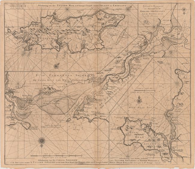
Subject: Isle of Man, Anglesey, Irish Sea

Period: 1730 (circa)

Publication: De Nieuwe Groote Lichtende Zee-Fakkel...

Color: Black & White

Size:
23.6 x 20.4 inches
59.9 x 51.8 cm
Download High Resolution Image
(or just click on image to launch the Zoom viewer)

This uncommon sheet includes three charts detailing islands in the Irish Sea. The chart at top left depicts the Isle of Man with north oriented to the top right corner. Running diagonally through the center of the sheet is a second chart, which focuses on the Menai Strait (here named Menay Riv.) between the island of Anglesey and mainland Wales. North is oriented to the bottom of the sheet. The final chart, located at bottom right, shows Holy Island (including the town of Holyhead) off the coast of Anglesey, with the bridge between the two illustrated as well. All three charts feature compass roses, rhumb lines, soundings, anchorages, and hazards within the water, and towns, settlements, churches, and topographical detail on the land.

References: Shirley (BL Atlases) M.KEU-2k #48.

Condition: B

On a toned sheet with light scattered foxing and a centerfold separation that enters map less than 1" at bottom.

Estimate: $375 - $450

Unsold

Closed on 9/16/2015

Archived