Catalog Archive
Auction 154, Lot 361

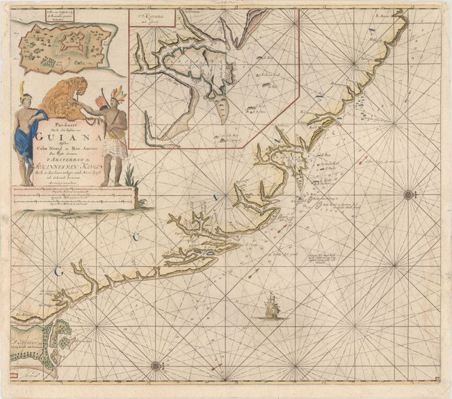
"Pas-kaart van de Zee-kusten van Guiana Tusschen Cabo Noord en Rio Amano...", Keulen, Johannes van
Subject: Guyana

Period: 1700 (circa)

Publication:

Color: Hand Color

Size:
23.2 x 20.4 inches
58.9 x 51.8 cm
Download High Resolution Image
(or just click on image to launch the Zoom viewer)

This scarce sea chart centers on the bay at what is now Georgetown in Guyana, with an inset of the mouth of the Essequibo River and a plan of Fort Cajana. The map is detailed with soundings, currents, shoals, and anchorages and embellished with rhumb lines, a sailing ship, and compass roses oriented with north to the right. The striking title cartouche features two natives with their tame leopards.

References:

Condition: B+

There are two light damp stains that enter into the image at bottom left and bottom right, as well as minor printer's ink residue. A few chips in the blank margins have been replaced with old paper.

Estimate: $475 - $600

Sold for: $350

Closed on 9/16/2015

Archived