Subject: Antigua
Period: 1864 (dated)
Publication:
Color: Black & White
Size:
18.1 x 23.6 inches
46 x 59.9 cm
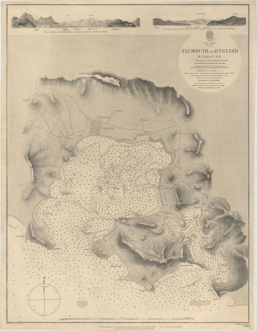
This detailed navigational chart depicts Falmouth and English Harbors along the southern coast of Antigua. The waters are filled with soundings, rocks, shoals, and fathoms lines. There is also excellent detail of the topography of the island surrounding the harbors, with roads, forts, buildings, chapels, and more identified. Above the chart are two coastal land approach views. The chart is based on a survey by Captain E. Barnett in 1847 with additions by J. Parsons in 1863. Engraved by J.C. Walker. The engraved seal of the Hydrographic Office along with "Price One & Sixpence" appears above the title.
References:
Condition: A
A nice impression on a sturdy sheet with a faint stain in bottom right corner.