Catalog Archive
Auction 154, Lot 327

"Mer des Antilles - Carte des Passages au Nord de Cuba Dressee d'Apres les Travaux Anglais Americains et Espagnols les Plus Recents...", Depot de la Marine

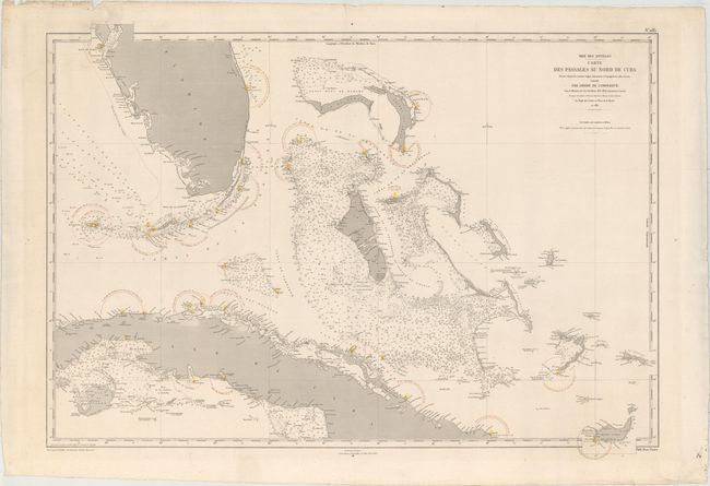
Subject: Bahamas, Cuba, & Southern Florida

Period: 1874 (dated)

Publication:

Color: Printed Color

Size:
36 x 25.9 inches
91.4 x 65.8 cm
Download High Resolution Image
(or just click on image to launch the Zoom viewer)

This detailed chart shows the Lucayan Archipelago, the southernmost tip of Florida, and northern Cuba. It includes a plethora of soundings, sea lights, hazards, bottom types, and other important navigational information. There are plenty of place names along the coasts. The chart is dated 1865, but has been corrected to 1874. Drafted by V. Carre and engraved by C.E. Collin.

References:

Condition: A

A fine impression on a watermarked sheet with original hand color marking lighthouses and some small, unobtrusive worm holes in the map image. There are some small chips and short edge tears in the blank margins, well away from map image.

Estimate: $275 - $350

Sold for: $250

Closed on 9/16/2015

Archived