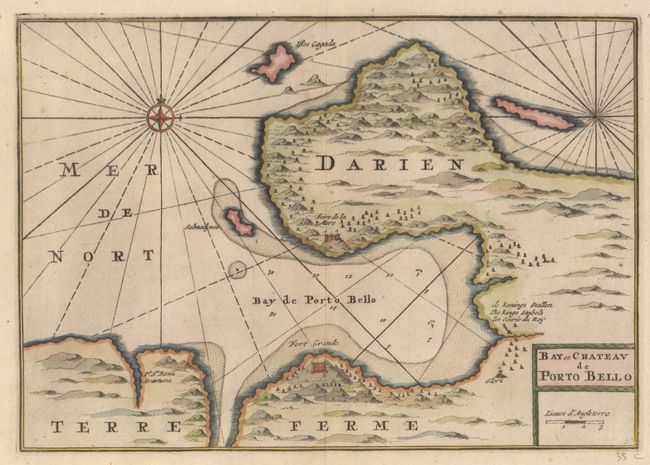
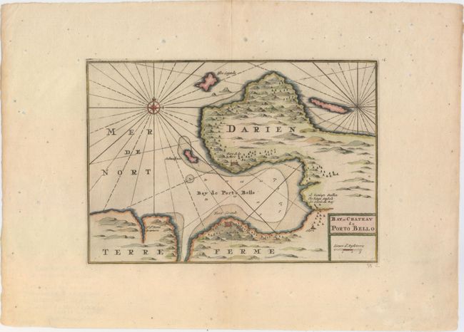
Subject: Portobelo Bay, Panama
Period: 1729 (circa)
Publication:
Color: Hand Color
Size:
12.2 x 8.6 inches
31 x 21.8 cm
This handsome map of historic Portobello Bay was copied from Pierre Mortier's map of circa 1692. Portobello was a strategic Spanish transfer point for gold and silver coming from South America. The map shows the locations of two forts protecting the bay -- Fort Grande (Santiago) and Fort de le Mare (San Felipe) -- as well as the location of the King's stables (San Jeronimo), where gold and silver was loaded onto ships. The map is beautifully presented with a compass rose and rhumb lines.
References: Kapp (MCC-73) #32.
Condition: B+
Attractive color on watermarked paper with very wide margins. There is light scattered foxing primarily confined to the blank margins.