Subject: Wyoming
Period: 1883 (dated)
Publication: HR Exec Doc 1, 49th Congress 1st Sess.
Color: Printed Color
Size:
24 x 20.5 inches
61 x 52.1 cm
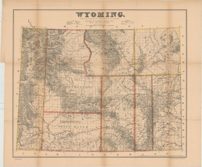
This uncommon map was originally published in Cheyenne, Wyoming. Issued seven years before statehood, it delineates only eight counties. Topography and hydrology are well developed, shows Yellowstone National Park, Shoshone Indian Reservation, towns, railroads, telegraph lines, common roads, and the areas containing coal and gypsum. In 1883 the cattle industry comprised 90% of all commerce, but the brutal winter of 1886-87 dealt a disastrous setback to this limited economy and contributed to delaying statehood. Blevins calls this "fantastic" map the most detailed and accurate of the period because of its scale and sources. Drawn by Frank & Fred Bond and printed by N. Peters, Photo-Lithographers, Washington, D.C.
References: Wheat (TMW) #916; Blevins #426.
Condition: B+
Issued folding and now flattened and backed with tissue to reinforce and repair several short fold separations. Light toning with more prominent toning along the folds.