Subject: Oklahoma, United States
Period: 1903 (published)
Publication: Tenth Annual Report of the Commission to the Five Civilized Tribes
Color:
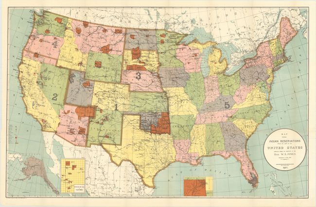
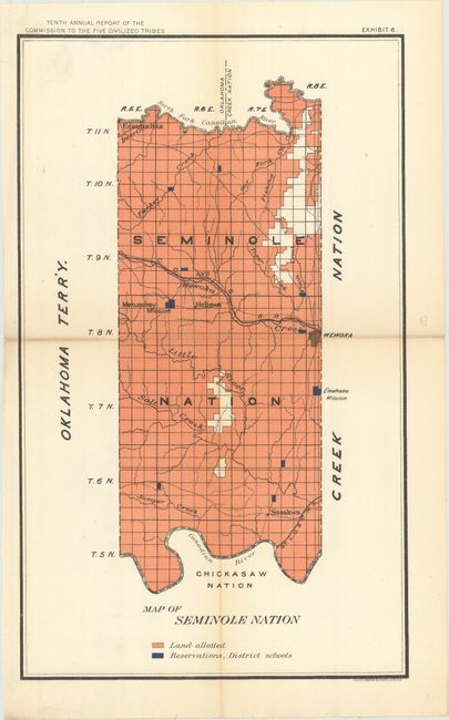
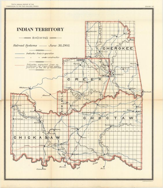
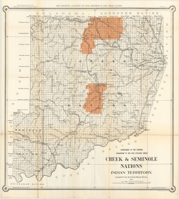
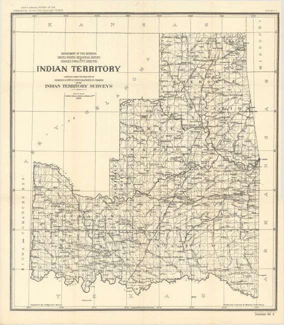
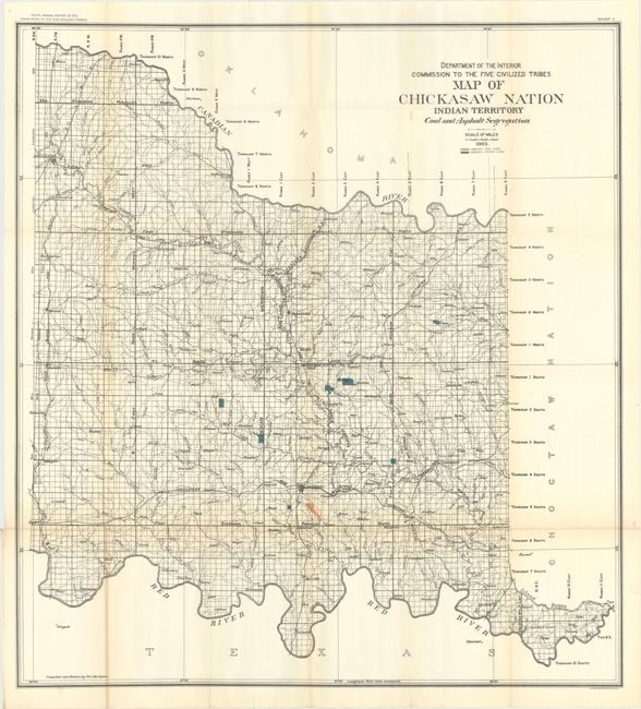
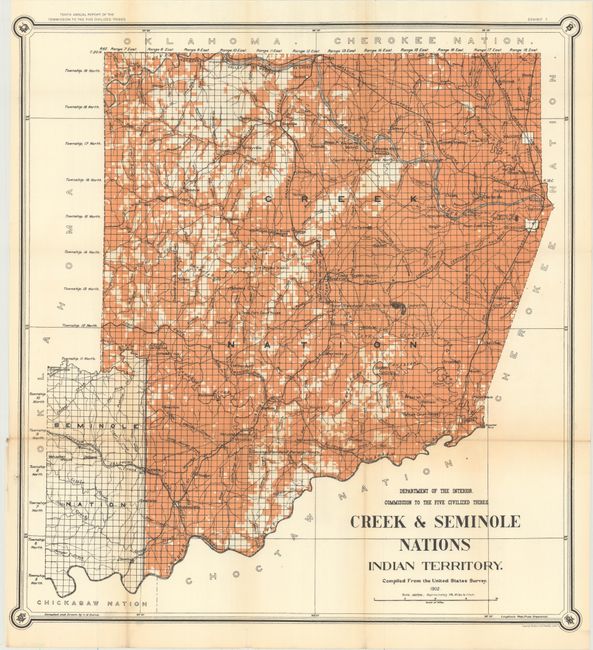
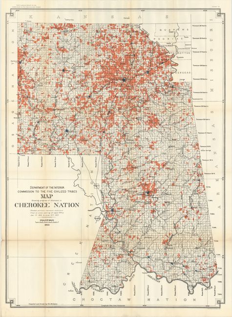
A fine set of twelve maps published as part of the Tenth Annual Report of the Commission to the Five Civilized Tribes. The Commission was appointed to negotiate with the Five Tribes for the extinguishment of their tribal title to lands by allotment, and division of the same among the members of the tribes. This commission became known as the Dawes Commission, after Senator Henry L. Dawes, who was largely responsible for the legislation. Their main task was to make an equitable division of nearly twenty million acres of land among more that 100,000 Indians. In 1895 the USGS began to conduct surveys of all lands in Indian Territory into townships, ranges and sections. These maps were used by the Dawes Commission to assist the citizens on the tribal rolls to select their individual plats of land. The list of maps include:
A. Map Showing Indian Reservations Within the Limits of the United States..., dated 1903, printed color (33.3 x 21.1").
B. Map of Seminole Nation, printed color (9.3 x 15.3").
C. Indian Territory Showing Railroad Systems, dated 1903, printed color (15.4 x 17.7").
D. Creek & Seminole Nations Indian Territory. Compiled from the United States Survey, dated 1902, printed color (24.6 x 26.2").
E. Indian Territory Compiled Under the Direction of Charles H. Fitch..., dated 1898, black & white (18.1 x 20.0").
F. Map of Chickasaw Nation Indian Territory Coal and Asphalt Segregation, dated 1903, printed color (30.5 x 33.2").
G. Creek & Seminole Nations Indian Territory. Compiled from the United States Survey, dated 1902, printed color (24.6 x 26.2").
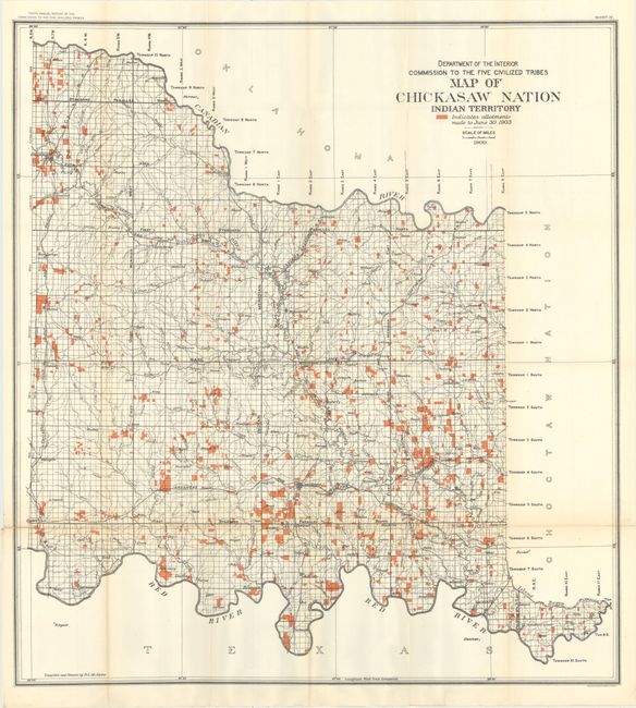
H. Map Showing Progress of Allotment in Cherokee Nation..., dated 1903, printed color (25.7 x 34.9").
I. Map of the Chickasaw Nation Indian Territory, dated 1900, printed color (30.5 x 33.1").
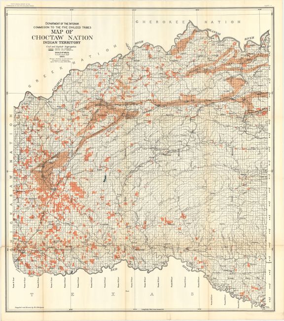
J. Map of Choctaw Nation Indian Territory Coal and Asphalt Segregation, dated 1903, printed color (32.8 x 36.8").
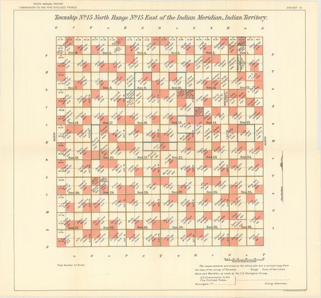
K. Township No. 15 North Range No. 15 East of the Indian Meridian, Indian Territory, printed color (17.0 x 16.2").
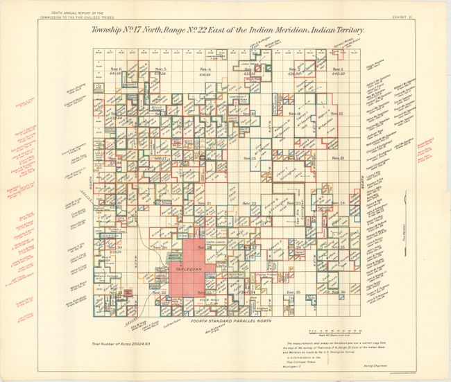
L. Township No. 17 North, Range No. 22 East of the Indian Meridian, Indian Territory, printed color (17.0 x 15.9").
References:
Condition: A
Overall clean and bright, with a few maps having faint toning along the folds or occasional faint color offsetting. Issued folding.