Catalog Archive
Auction 154, Lot 210

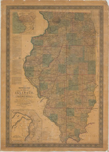
"New Sectional Map of the State of Illinois. Compiled from the United States Surveys...", Colton, Joseph Hutchins
Subject: Illinois

Period: 1852 (dated)

Publication:

Color: Hand Color

Size:
28.1 x 40.8 inches
71.4 x 103.6 cm
Download High Resolution Image
(or just click on image to launch the Zoom viewer)

This very large and highly detailed wall map, created by J.M. Peck, John Messenger, and A.J. Mathewson, contains a trove of information. The map features two large insets: "Vicinity of Alton & St. Louis" and "Vicinity of Galena, the Lead Region and part of Wisconsin and Iowa." This example is surrounded by a lovely decorative border, and includes an extensive legend, distance scales, and a large table discussing Public Land and Land Districts. A nice example of this early Colton wall map. Rollers not present.

References:

Condition: B

The varnish has yellowed somewhat with a small, 2.5" circular stain at top. There are a few cracks and chips in the map with more pronounced chipping in the blank margins.

Estimate: $400 - $500

Sold for: $200

Closed on 9/16/2015

Archived