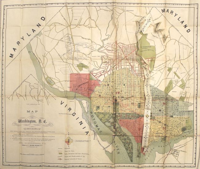
Subject: Washington, D.C.
Period: 1887 (dated)
Publication:
Color: Printed Color
Size:
30.2 x 24.4 inches
76.7 x 62 cm
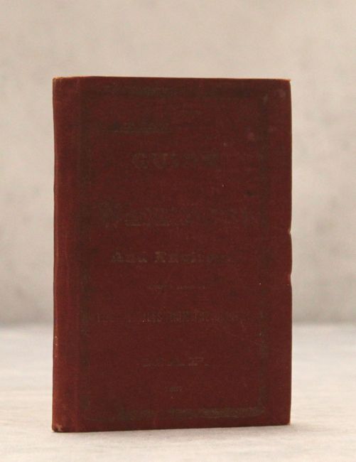
This unusual pocket map was produced by Axel Silversparre and published by R.E. Whitman. It features a measuring tape attached to the map "for instantly locating points of interest within a radius of twenty miles from the Capitol." The map, compiled from official sources, is color-coded to show the four quarters of the city and locates railroads, street car lines, proposed road extensions, as well as parks and cemeteries. The map folds into red cloth wrappers and includes 72 pages of places of interest along with the corresponding coordinates for locating them on the map. No auction results or dealer prices have been listed in the last 30 years.
References: Phillips (Maps) p. 1034; Phillips (DC) #PW319.
Condition: C+
The map is mostly clean with light color offsetting and some toning along the folds. There are several long fold separations along the bottom two folds with some minor loss along several folds. The measuring tape is mis-folded but in otherwise good condition. The text and covers are in very good condition with minor soiling and light wear.